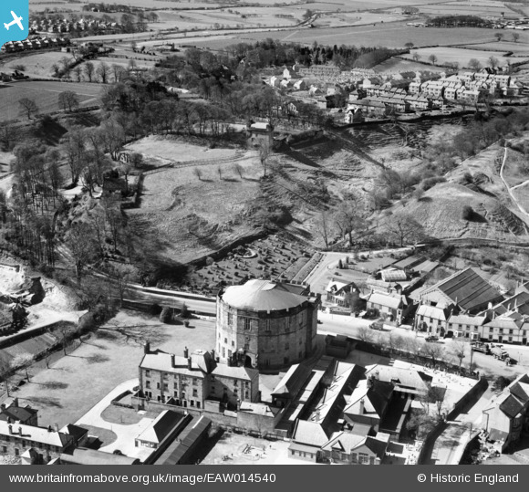
EAW014540 ENGLAND (1948). Court House, Morpeth Castle and Haw Hill, Morpeth, 1948
© Copyright OpenStreetMap contributors and licensed by the OpenStreetMap Foundation. 2024. Cartography is licensed as CC BY-SA.
Nearby Images (5)
Details
| Title | [EAW014540] Court House, Morpeth Castle and Haw Hill, Morpeth, 1948 |
| Reference | EAW014540 |
| Date | 15-April-1948 |
| Link | |
| Place name | MORPETH |
| Parish | MORPETH |
| District | |
| Country | ENGLAND |
| Easting / Northing | 420077, 585610 |
| Longitude / Latitude | -1.6848220608078, 55.164347599112 |
| National Grid Reference | NZ201856 |
Pins
 gp |
Thursday 15th of August 2019 08:23:34 AM |


![[EAW014540] Court House, Morpeth Castle and Haw Hill, Morpeth, 1948](http://britainfromabove.org.uk/sites/all/libraries/aerofilms-images/public/100x100/EAW/014/EAW014540.jpg)
![[EAW014539] Court House, Morpeth Castle and Carlisle Park, Morpeth, 1948](http://britainfromabove.org.uk/sites/all/libraries/aerofilms-images/public/100x100/EAW/014/EAW014539.jpg)
![[EAW014541] The remains of Morpeth Castle, Morpeth, 1948](http://britainfromabove.org.uk/sites/all/libraries/aerofilms-images/public/100x100/EAW/014/EAW014541.jpg)
![[EAW014538] The area surrounding Morpeth Castle, Morpeth, 1948. This image has been produced from a damaged negative.](http://britainfromabove.org.uk/sites/all/libraries/aerofilms-images/public/100x100/EAW/014/EAW014538.jpg)
![[EPW019777] The New and Old Bridges, Morpeth, 1927](http://britainfromabove.org.uk/sites/all/libraries/aerofilms-images/public/100x100/EPW/019/EPW019777.jpg)