
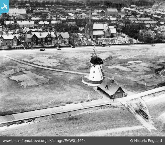
EAW014624 ENGLAND (1948). Lytham Windmill and Lifeboat House, Lytham, 1948
© Copyright OpenStreetMap contributors and licensed by the OpenStreetMap Foundation. 2025. Cartography is licensed as CC BY-SA.
Nearby Images (3)
EAW014624

EAW014623

EPW038759

Details
| Title | [EAW014624] Lytham Windmill and Lifeboat House, Lytham, 1948 |
| Reference | EAW014624 |
| Date | 21-April-1948 |
| Link | |
| Place name | LYTHAM |
| Parish | |
| District | |
| Country | ENGLAND |
| Easting / Northing | 337073, 427033 |
| Longitude / Latitude | -2.9540633329485, 53.735661854587 |
| National Grid Reference | SD371270 |
Pins
 Matt Aldred edob.mattaldred.com |
Monday 31st of March 2025 06:56:15 PM | |
 redmist |
Thursday 11th of February 2021 11:42:39 AM |