
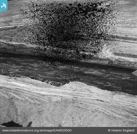
EAW015500 ENGLAND (1948). Billingley, Open Cast Coal Quarry south of the village, 1948.
© Copyright OpenStreetMap contributors and licensed by the OpenStreetMap Foundation. 2025. Cartography is licensed as CC BY-SA.
Nearby Images (19)
EAW015500

EAW015499

EAW015484

EAW015501

EAW015502

EAW015498

EAW015485

EAW015497

EAW015486

EAW015490

EAW015488

EAW015491

EAW015492

EAW015487

EAW025615

EAW015495

EAW015503

EAW015493

EAW025611

Details
| Title | [EAW015500] Billingley, Open Cast Coal Quarry south of the village, 1948. |
| Reference | EAW015500 |
| Date | 14-May-1948 |
| Link | |
| Place name | |
| Parish | BILLINGLEY |
| District | |
| Country | ENGLAND |
| Easting / Northing | 443318, 403680 |
| Longitude / Latitude | -1.3464628385888, 53.527747208613 |
| National Grid Reference | SE433037 |
Pins
Be the first to add a comment to this image!
User Comment Contributions
See EAW015486, this section of site is bottom centre of picture. The drag crane will be just to the right out of shot. The spoil falling on the right is clearly visible on EAW015486 |
 TomRobin |
Monday 6th of October 2014 08:38:57 PM |
This series of three photographs are of the same location. EAW015497 EAW015498 EAW015499 There is an overlap with the same information on each of the three photographs. EAW015500 is probably of the same location but I cannot identify anything positively as being at the same location, apart from a very large hole in the ground! |
 Class31 |
Sunday 5th of January 2014 06:08:40 PM |