
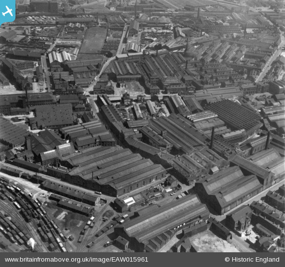
EAW015961 ENGLAND (1948). Industrial area at Pottery Field, Hunslet, 1948. This image has been produced from a print.
© Copyright OpenStreetMap contributors and licensed by the OpenStreetMap Foundation. 2025. Cartography is licensed as CC BY-SA.
Nearby Images (28)
EAW015961

EAW015960

EAW015966

EAW015965

EAW015963

EAW015962

EAW038452

EAW038460

EAW038455

EAW015964

EPW034097

EPW034099

EAW038461

EPW031642

EAW038459

EAW038458

EPW031643

EPW034095

EPW034096

EPW031644

EPW034098

EAW031361

EAW031353

EAW031356

EAW031354

EAW031360

EAW031357

EAW031359

Details
| Title | [EAW015961] Industrial area at Pottery Field, Hunslet, 1948. This image has been produced from a print. |
| Reference | EAW015961 |
| Date | 19-May-1948 |
| Link | |
| Place name | HUNSLET |
| Parish | |
| District | |
| Country | ENGLAND |
| Easting / Northing | 430637, 432412 |
| Longitude / Latitude | -1.5349382732051, 53.786909685119 |
| National Grid Reference | SE306324 |
