
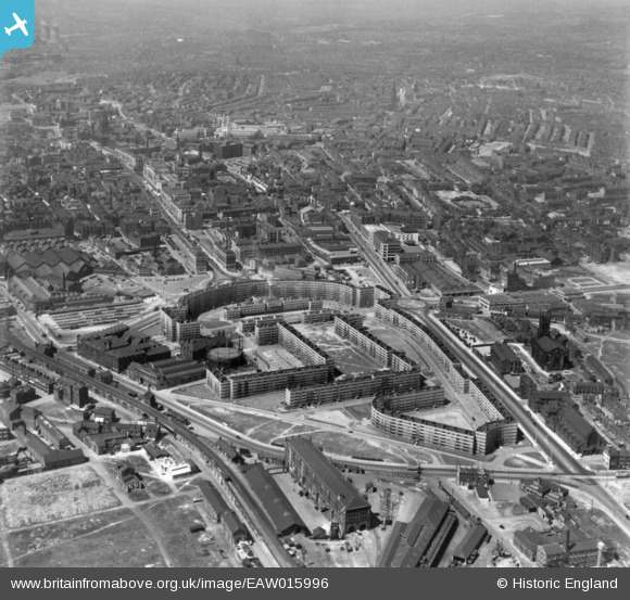
EAW015996 ENGLAND (1948). Quarry Hill Flats and environs, Leeds, 1948. This image has been produced from a print.
© Copyright OpenStreetMap contributors and licensed by the OpenStreetMap Foundation. 2025. Cartography is licensed as CC BY-SA.
Nearby Images (15)
EAW015996

EAW014656

EPW057201

EAW015737

EAW046761

EAW028063

EAW028064

EAW046762

EAW046760

EAW046757

EAW046759

EPW061489

EAW046763

EAW046758

EAW002637

Details
| Title | [EAW015996] Quarry Hill Flats and environs, Leeds, 1948. This image has been produced from a print. |
| Reference | EAW015996 |
| Date | 19-May-1948 |
| Link | |
| Place name | LEEDS |
| Parish | |
| District | |
| Country | ENGLAND |
| Easting / Northing | 430752, 433742 |
| Longitude / Latitude | -1.5330599086014, 53.798857902998 |
| National Grid Reference | SE308337 |
Pins
Be the first to add a comment to this image!