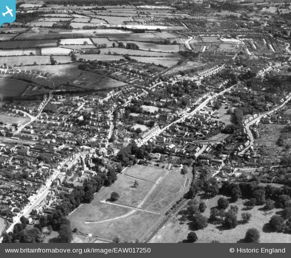
EAW017250 ENGLAND (1948). The town, Hemel Hempstead, 1948. This image has been produced from a print.
© Copyright OpenStreetMap contributors and licensed by the OpenStreetMap Foundation. 2025. Cartography is licensed as CC BY-SA.
Nearby Images (12)
Details
| Title | [EAW017250] The town, Hemel Hempstead, 1948. This image has been produced from a print. |
| Reference | EAW017250 |
| Date | 20-July-1948 |
| Link | |
| Place name | HEMEL HEMPSTEAD |
| Parish | |
| District | |
| Country | ENGLAND |
| Easting / Northing | 505564, 207495 |
| Longitude / Latitude | -0.4704202301147, 51.755729716784 |
| National Grid Reference | TL056075 |


![[EAW017250] The town, Hemel Hempstead, 1948. This image has been produced from a print.](http://britainfromabove.org.uk/sites/all/libraries/aerofilms-images/public/100x100/EAW/017/EAW017250.jpg)
![[EPW022457] The town centre, Hemel Hempstead, 1928](http://britainfromabove.org.uk/sites/all/libraries/aerofilms-images/public/100x100/EPW/022/EPW022457.jpg)
![[EPW052869] Marlowes and environs, Hemel Hempstead, 1937](http://britainfromabove.org.uk/sites/all/libraries/aerofilms-images/public/100x100/EPW/052/EPW052869.jpg)
![[EPW052865] The Junction of Marlowes and Bury Road (Queensway), Hemel Hempstead, 1937](http://britainfromabove.org.uk/sites/all/libraries/aerofilms-images/public/100x100/EPW/052/EPW052865.jpg)
![[EAW014884] The town, Hemel Hempstead, from the south-west, 1948. This image has been produced from a print.](http://britainfromabove.org.uk/sites/all/libraries/aerofilms-images/public/100x100/EAW/014/EAW014884.jpg)
![[EPW052866] The Junction of Marlowes and Bury Road (Queensway) and environs, Hemel Hempstead, 1937](http://britainfromabove.org.uk/sites/all/libraries/aerofilms-images/public/100x100/EPW/052/EPW052866.jpg)
![[EAW014883] Marlowes, Queensway and environs, Hemel Hempstead, 1948. This image has been produced from a print.](http://britainfromabove.org.uk/sites/all/libraries/aerofilms-images/public/100x100/EAW/014/EAW014883.jpg)
![[EPW017818] St Mary's Church and the High Street, Hemel Hempstead, 1927](http://britainfromabove.org.uk/sites/all/libraries/aerofilms-images/public/100x100/EPW/017/EPW017818.jpg)
![[EPW022456] The town centre, Hemel Hempstead, from the south-west, 1928](http://britainfromabove.org.uk/sites/all/libraries/aerofilms-images/public/100x100/EPW/022/EPW022456.jpg)
![[EPW052868] Marlowes, Alexander Road and environs, Hemel Hempstead, from the north, 1937](http://britainfromabove.org.uk/sites/all/libraries/aerofilms-images/public/100x100/EPW/052/EPW052868.jpg)
![[EAW017251] The town, Hemel Hempstead, from the north-west, 1948. This image has been produced from a print.](http://britainfromabove.org.uk/sites/all/libraries/aerofilms-images/public/100x100/EAW/017/EAW017251.jpg)
![[EAW017252] The town, Hemel Hempstead, from the north-west, 1948. This image has been produced from a print.](http://britainfromabove.org.uk/sites/all/libraries/aerofilms-images/public/100x100/EAW/017/EAW017252.jpg)
