
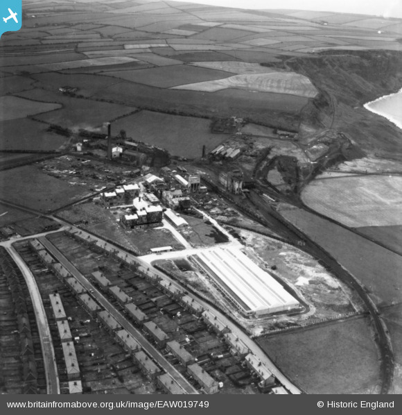
EAW019749 ENGLAND (1948). The Marchon Products Ltd Works, Whitehaven, 1948. This image has been produced from a print.
© Copyright OpenStreetMap contributors and licensed by the OpenStreetMap Foundation. 2025. Cartography is licensed as CC BY-SA.
Nearby Images (20)
EAW019749

EAW019748

EAW028346

EAW028349

EAW028345

EAW028343

EAW028347

EAW019743A

EAW028339

EAW028344

EAW019746

EAW028348

EAW028342

EAW019747

EAW028340

EAW028341

EAW019744

EPW042093

EAW019743

EAW019745

Details
| Title | [EAW019749] The Marchon Products Ltd Works, Whitehaven, 1948. This image has been produced from a print. |
| Reference | EAW019749 |
| Date | 15-October-1948 |
| Link | |
| Place name | WHITEHAVEN |
| Parish | |
| District | |
| Country | ENGLAND |
| Easting / Northing | 296617, 516210 |
| Longitude / Latitude | -3.5977749532866, 54.530473937709 |
| National Grid Reference | NX966162 |
Pins
Be the first to add a comment to this image!