
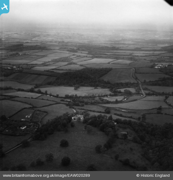
EAW020289 ENGLAND (1948). Fishleigh House and surrounding countryside, Hatherleigh, from the south-east, 1948. This image has been produced from a print.
© Copyright OpenStreetMap contributors and licensed by the OpenStreetMap Foundation. 2025. Cartography is licensed as CC BY-SA.
Nearby Images (5)
EAW020289

EAW020288

EAW020287

EAW020285

EAW020286

Details
| Title | [EAW020289] Fishleigh House and surrounding countryside, Hatherleigh, from the south-east, 1948. This image has been produced from a print. |
| Reference | EAW020289 |
| Date | 27-October-1948 |
| Link | |
| Place name | HATHERLEIGH |
| Parish | HATHERLEIGH |
| District | |
| Country | ENGLAND |
| Easting / Northing | 254117, 105741 |
| Longitude / Latitude | -4.0718337258834, 50.832233690167 |
| National Grid Reference | SS541057 |
Pins
 Charles Dale |
Tuesday 26th of January 2016 12:54:07 PM |