
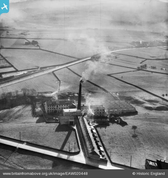
EAW020448 ENGLAND (1948). Syke Side Cotton Mill, Haslingden, 1948
© Copyright OpenStreetMap contributors and licensed by the OpenStreetMap Foundation. 2025. Cartography is licensed as CC BY-SA.
Nearby Images (7)
EAW020448

EAW020450

EAW020449

EAW020447

EAW020444

EAW020446

EAW020445

Details
| Title | [EAW020448] Syke Side Cotton Mill, Haslingden, 1948 |
| Reference | EAW020448 |
| Date | 8-November-1948 |
| Link | |
| Place name | HASLINGDEN |
| Parish | |
| District | |
| Country | ENGLAND |
| Easting / Northing | 379156, 421931 |
| Longitude / Latitude | -2.3157027267721, 53.693180722974 |
| National Grid Reference | SD792219 |
Pins
 wadey |
Monday 24th of November 2014 03:43:41 PM |