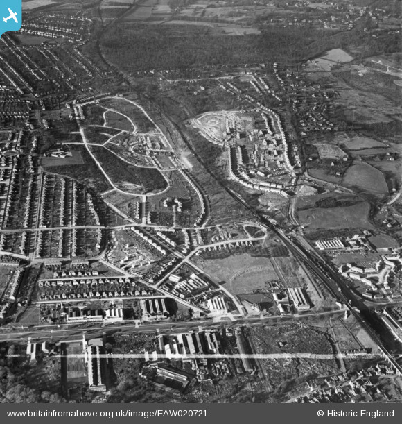
EAW020721 ENGLAND (1948). New housing development around Tillingbourne Green and Ravensbury Road, Poverest, 1948. This image was marked by Aerofilms Ltd for photo editing.
© Copyright OpenStreetMap contributors and licensed by the OpenStreetMap Foundation. 2025. Cartography is licensed as CC BY-SA.
Details
| Title | [EAW020721] New housing development around Tillingbourne Green and Ravensbury Road, Poverest, 1948. This image was marked by Aerofilms Ltd for photo editing. |
| Reference | EAW020721 |
| Date | 24-December-1948 |
| Link | |
| Place name | POVEREST |
| Parish | |
| District | |
| Country | ENGLAND |
| Easting / Northing | 546451, 168175 |
| Longitude / Latitude | 0.1052475556847, 51.393190842505 |
| National Grid Reference | TQ465682 |
Pins
 garyb |
Monday 7th of July 2014 10:52:01 PM | |
 garyb |
Monday 7th of July 2014 10:44:53 PM | |
 Gone2Kent |
Friday 31st of January 2014 10:45:57 PM |


![[EAW020721] New housing development around Tillingbourne Green and Ravensbury Road, Poverest, 1948. This image was marked by Aerofilms Ltd for photo editing.](http://britainfromabove.org.uk/sites/all/libraries/aerofilms-images/public/100x100/EAW/020/EAW020721.jpg)
![[EAW020742] Construction of housing around 88 Ravensbury Road, St Paul's Cray, 1948](http://britainfromabove.org.uk/sites/all/libraries/aerofilms-images/public/100x100/EAW/020/EAW020742.jpg)
![[EAW020741] Constuction of 17-23 Clarendon Green, St Paul's Cray, 1948](http://britainfromabove.org.uk/sites/all/libraries/aerofilms-images/public/100x100/EAW/020/EAW020741.jpg)
![[EAW020718] Robin Hood Green and new housing development around Tillingbourne Green and Ravensbury Road, Poverest, 1948](http://britainfromabove.org.uk/sites/all/libraries/aerofilms-images/public/100x100/EAW/020/EAW020718.jpg)