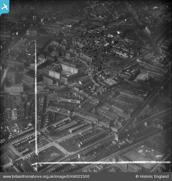
EAW021500 ENGLAND (1949). Falmouth Road and environs, Newington, 1949. This image was marked by Aerofilms Ltd for photo editing.
© Copyright OpenStreetMap contributors and licensed by the OpenStreetMap Foundation. 2025. Cartography is licensed as CC BY-SA.
Nearby Images (28)
EAW021500

EPW015759

EAW021508

EPW015760

EPW016619

EAW021510

EAW021506

EPW015751

EPW015752

EPW016620

EAW021509

EPW007726

EAW021505

EPW007728

EPW007725

EPW015749

EPW007724

EAW021507

EPW015750

EAW021503

EAW021502

EPW007727

EPW015753

EAW021501

EPW007723

EPW015754

EPW055342

EAW021504

Details
| Title | [EAW021500] Falmouth Road and environs, Newington, 1949. This image was marked by Aerofilms Ltd for photo editing. |
| Reference | EAW021500 |
| Date | 19-March-1949 |
| Link | |
| Place name | NEWINGTON |
| Parish | |
| District | |
| Country | ENGLAND |
| Easting / Northing | 532452, 179285 |
| Longitude / Latitude | -0.091704635208341, 51.496484542577 |
| National Grid Reference | TQ325793 |
Pins
 Leslie B |
Thursday 25th of August 2022 12:05:12 PM | |
Chelsea61 |
Thursday 27th of March 2014 07:07:05 PM | |
 Alan McFaden |
Monday 27th of January 2014 10:24:04 PM |