
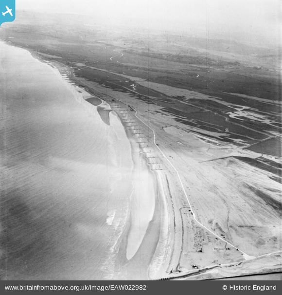
EAW022982 ENGLAND (1949). The Nook, Rye Harbour, from the north-east, 1949
© Copyright OpenStreetMap contributors and licensed by the OpenStreetMap Foundation. 2025. Cartography is licensed as CC BY-SA.
Details
| Title | [EAW022982] The Nook, Rye Harbour, from the north-east, 1949 |
| Reference | EAW022982 |
| Date | 6-May-1949 |
| Link | |
| Place name | RYE HARBOUR |
| Parish | ICKLESHAM |
| District | |
| Country | ENGLAND |
| Easting / Northing | 594523, 117802 |
| Longitude / Latitude | 0.76828542546492, 50.926276935333 |
| National Grid Reference | TQ945178 |
Pins
 Matt Aldred edob.mattaldred.com |
Tuesday 9th of March 2021 02:28:38 PM | |
Matt Aldred edob.mattaldred.com |
Tuesday 9th of March 2021 02:27:58 PM | |
Matt Aldred edob.mattaldred.com |
Tuesday 9th of March 2021 02:27:42 PM | |
 jrussill |
Thursday 13th of November 2014 06:01:34 PM | |
jrussill |
Thursday 13th of November 2014 06:00:05 PM |
User Comment Contributions
 WW2 Pillboxes |
jrussill |
Thursday 13th of November 2014 06:02:33 PM |