
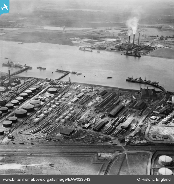
EAW023043 ENGLAND (1949). The Purfleet Deep Wharf & Storage Co Ltd site and environs, Purfleet, 1949
© Copyright OpenStreetMap contributors and licensed by the OpenStreetMap Foundation. 2025. Cartography is licensed as CC BY-SA.
Nearby Images (11)
EAW023043

EAW023044

EAW023042

EAW023046

EAW023038

EAW023039

EPW026350

EAW023045

EAW023040

EAW023041

EPW006266

Details
| Title | [EAW023043] The Purfleet Deep Wharf & Storage Co Ltd site and environs, Purfleet, 1949 |
| Reference | EAW023043 |
| Date | 10-May-1949 |
| Link | |
| Place name | PURFLEET |
| Parish | |
| District | |
| Country | ENGLAND |
| Easting / Northing | 556478, 177183 |
| Longitude / Latitude | 0.25325127690643, 51.471456801693 |
| National Grid Reference | TQ565772 |
Pins
Be the first to add a comment to this image!