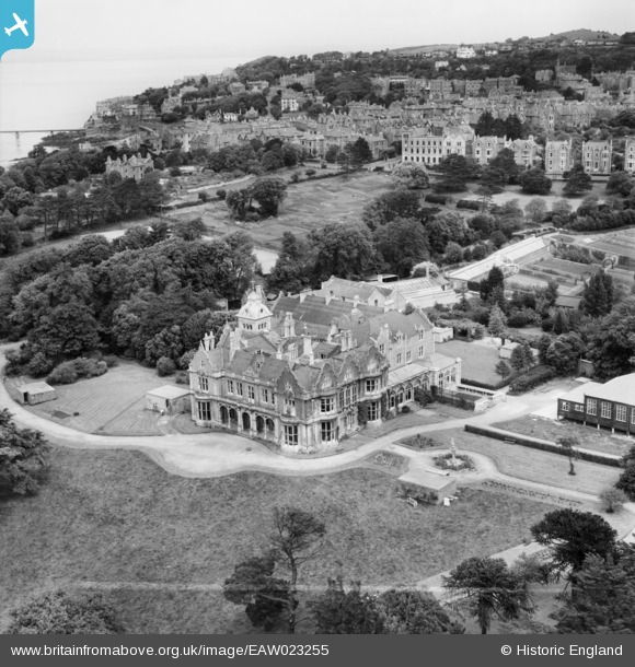
EAW023255 ENGLAND (1949). St Brandon's School (Clevedon Hall), Clevedon, 1949. This image was marked by Aerofilms Ltd for photo editing.
© Copyright OpenStreetMap contributors and licensed by the OpenStreetMap Foundation. 2025. Cartography is licensed as CC BY-SA.
Nearby Images (6)
Details
| Title | [EAW023255] St Brandon's School (Clevedon Hall), Clevedon, 1949. This image was marked by Aerofilms Ltd for photo editing. |
| Reference | EAW023255 |
| Date | 23-May-1949 |
| Link | |
| Place name | CLEVEDON |
| Parish | CLEVEDON |
| District | |
| Country | ENGLAND |
| Easting / Northing | 340057, 171129 |
| Longitude / Latitude | -2.8624466208573, 51.435493878006 |
| National Grid Reference | ST401711 |
Pins
 Matt Aldred edob.mattaldred.com |
Thursday 14th of March 2024 12:08:43 PM | |
 Matt Aldred edob.mattaldred.com |
Friday 8th of March 2024 02:17:39 PM | |
 Matt Aldred edob.mattaldred.com |
Monday 21st of March 2022 12:57:04 PM | |
 Matt Aldred edob.mattaldred.com |
Monday 21st of March 2022 12:56:58 PM | |
 Matt Aldred edob.mattaldred.com |
Monday 21st of March 2022 12:56:48 PM | |
 Matt Aldred edob.mattaldred.com |
Monday 21st of March 2022 12:56:37 PM | |
 Class31 |
Saturday 20th of December 2014 08:36:08 PM |


![[EAW023255] St Brandon's School (Clevedon Hall), Clevedon, 1949. This image was marked by Aerofilms Ltd for photo editing.](http://britainfromabove.org.uk/sites/all/libraries/aerofilms-images/public/100x100/EAW/023/EAW023255.jpg)
![[EPW024059] Clevedon Hall, Clevedon, 1928](http://britainfromabove.org.uk/sites/all/libraries/aerofilms-images/public/100x100/EPW/024/EPW024059.jpg)
![[EPW033272] Clevedon Road and environs, Clevedon, 1930](http://britainfromabove.org.uk/sites/all/libraries/aerofilms-images/public/100x100/EPW/033/EPW033272.jpg)
![[EAW023253] St Brandon's School (Clevedon Hall) and environs, Clevedon, 1949. This image was marked by Aerofilms Ltd for photo editing.](http://britainfromabove.org.uk/sites/all/libraries/aerofilms-images/public/100x100/EAW/023/EAW023253.jpg)
![[EAW023254] St Brandon's School (Clevedon Hall) and environs, Clevedon, 1949. This image was marked by Aerofilms Ltd for photo editing.](http://britainfromabove.org.uk/sites/all/libraries/aerofilms-images/public/100x100/EAW/023/EAW023254.jpg)
![[EPW024070] Elton Road and environs, Clevedon, 1928](http://britainfromabove.org.uk/sites/all/libraries/aerofilms-images/public/100x100/EPW/024/EPW024070.jpg)