
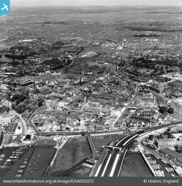
EAW023272 ENGLAND (1949). Cleared areas following bomb damage around Portsea and environs, Portsmouth, from the south-west, 1949. This image has been produced from a print.
© Copyright OpenStreetMap contributors and licensed by the OpenStreetMap Foundation. 2025. Cartography is licensed as CC BY-SA.
Nearby Images (2)
EAW023272

EAW178152

Details
| Title | [EAW023272] Cleared areas following bomb damage around Portsea and environs, Portsmouth, from the south-west, 1949. This image has been produced from a print. |
| Reference | EAW023272 |
| Date | 19-May-1949 |
| Link | |
| Place name | PORTSMOUTH |
| Parish | |
| District | |
| Country | ENGLAND |
| Easting / Northing | 463077, 100176 |
| Longitude / Latitude | -1.1048819476015, 50.797145271248 |
| National Grid Reference | SU631002 |
Pins
 Brightonboy |
Tuesday 21st of September 2021 11:01:09 PM | |
Brightonboy |
Tuesday 21st of September 2021 10:54:37 PM | |
Brightonboy |
Tuesday 21st of September 2021 10:46:51 PM | |
Phil |
Tuesday 21st of September 2021 10:10:49 PM | |
John Wass |
Thursday 7th of February 2019 11:08:44 AM | |
John Wass |
Thursday 7th of February 2019 11:07:13 AM | |
John Wass |
Saturday 25th of July 2015 09:03:26 PM | |
David |
Monday 6th of April 2015 05:41:09 PM | |
aka Victory Gate |
Brightonboy |
Tuesday 21st of September 2021 10:58:40 PM |