
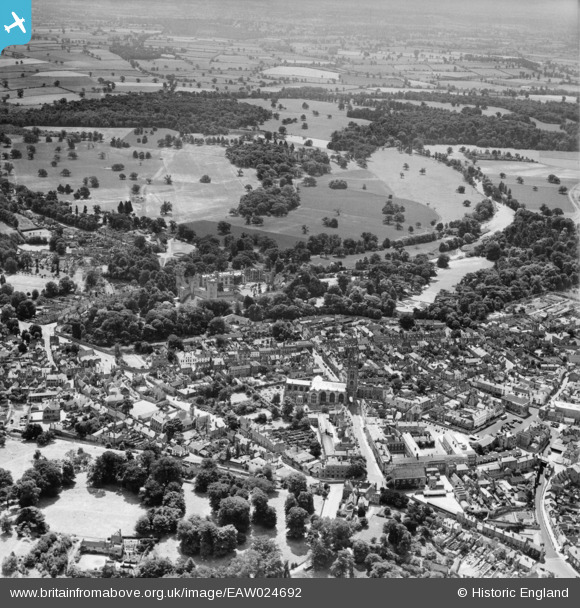
EAW024692 ENGLAND (1949). St Mary's Church, Warwick Castle and the town centre, Warwick, from the north, 1949
© Copyright OpenStreetMap contributors and licensed by the OpenStreetMap Foundation. 2025. Cartography is licensed as CC BY-SA.
Nearby Images (18)
EAW024692

EAW042927

EAW024695

EPW035695

EAW003264

EAW042928

EPW000412

EPW000410

EAW042926

EPW053227

EPW001213

EAW024691

EPW053229

EAW003265

EPW053228

EPW019742

EAW042934

EAW024696

Details
| Title | [EAW024692] St Mary's Church, Warwick Castle and the town centre, Warwick, from the north, 1949 |
| Reference | EAW024692 |
| Date | 12-July-1949 |
| Link | |
| Place name | WARWICK |
| Parish | WARWICK |
| District | |
| Country | ENGLAND |
| Easting / Northing | 428191, 265046 |
| Longitude / Latitude | -1.5867085894831, 52.282440326056 |
| National Grid Reference | SP282650 |
Pins
 Bob Curtis |
Thursday 4th of June 2020 09:44:03 AM | |
Bob Curtis |
Thursday 4th of June 2020 09:42:27 AM | |
Bob Curtis |
Thursday 4th of June 2020 09:41:29 AM |