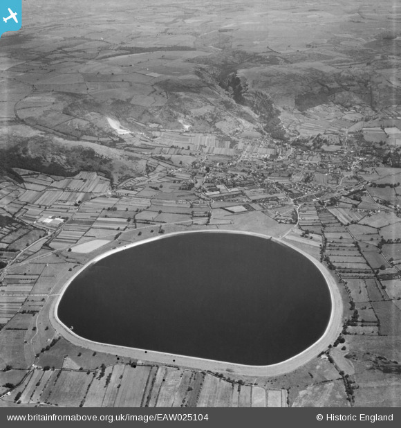
EAW025104 ENGLAND (1949). Cheddar Reservoir, Cheddar, from the west, 1949
© Copyright OpenStreetMap contributors and licensed by the OpenStreetMap Foundation. 2025. Cartography is licensed as CC BY-SA.
Details
| Title | [EAW025104] Cheddar Reservoir, Cheddar, from the west, 1949 |
| Reference | EAW025104 |
| Date | 25-July-1949 |
| Link | |
| Place name | CHEDDAR |
| Parish | CHEDDAR |
| District | |
| Country | ENGLAND |
| Easting / Northing | 344147, 153690 |
| Longitude / Latitude | -2.800867861782, 51.27910322074 |
| National Grid Reference | ST441537 |
Pins
 clippedwings |
Saturday 21st of December 2013 09:50:20 PM | |
 clippedwings |
Saturday 21st of December 2013 09:49:25 PM | |
 clippedwings |
Saturday 21st of December 2013 09:45:18 PM |
User Comment Contributions
Cheddar Reservoir, 13/04/2016 |
 Class31 |
Friday 15th of April 2016 04:52:42 PM |


![[EAW025104] Cheddar Reservoir, Cheddar, from the west, 1949](http://britainfromabove.org.uk/sites/all/libraries/aerofilms-images/public/100x100/EAW/025/EAW025104.jpg)
![[EAW025101] Cheddar Reservoir, Cheddar, 1949](http://britainfromabove.org.uk/sites/all/libraries/aerofilms-images/public/100x100/EAW/025/EAW025101.jpg)
![[EAW025102] Cheddar Reservoir, Cheddar, 1949](http://britainfromabove.org.uk/sites/all/libraries/aerofilms-images/public/100x100/EAW/025/EAW025102.jpg)