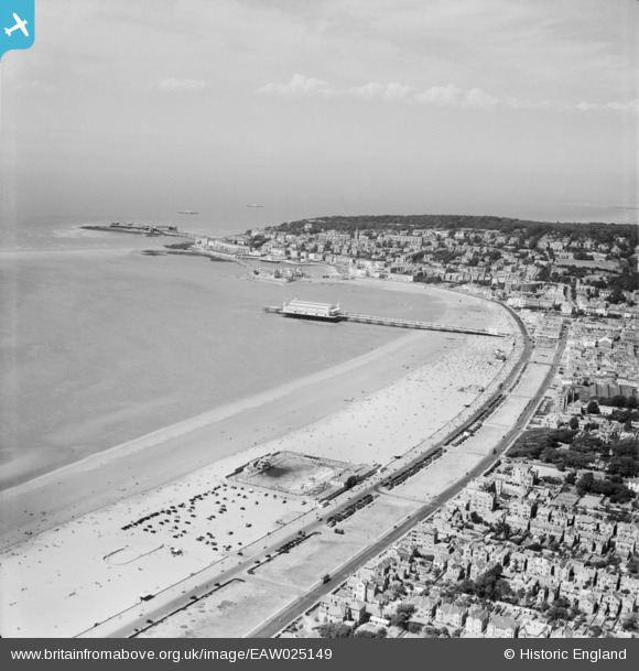
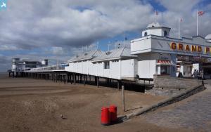
EAW025149 ENGLAND (1949). Weston Bay from the Swimming Pool (Tropicana) to Birnbeck Island, Weston-super-Mare, from the south, 1949
© Copyright OpenStreetMap contributors and licensed by the OpenStreetMap Foundation. 2025. Cartography is licensed as CC BY-SA.
Nearby Images (12)
Details
| Title | [EAW025149] Weston Bay from the Swimming Pool (Tropicana) to Birnbeck Island, Weston-super-Mare, from the south, 1949 |
| Reference | EAW025149 |
| Date | 25-July-1949 |
| Link | |
| Place name | WESTON-SUPER-MARE |
| Parish | WESTON-SUPER-MARE |
| District | |
| Country | ENGLAND |
| Easting / Northing | 331534, 160868 |
| Longitude / Latitude | -2.9830762164694, 51.342267477532 |
| National Grid Reference | ST315609 |
Pins
 Alan McFaden |
Sunday 12th of January 2014 06:58:24 PM | |
 Alan McFaden |
Sunday 12th of January 2014 06:57:39 PM |


![[EAW025149] Weston Bay from the Swimming Pool (Tropicana) to Birnbeck Island, Weston-super-Mare, from the south, 1949](http://britainfromabove.org.uk/sites/all/libraries/aerofilms-images/public/100x100/EAW/025/EAW025149.jpg)
![[EPW001033] View over Weston-Super-Mare, Weston-Super-Mare, from the south-west, 1920](http://britainfromabove.org.uk/sites/all/libraries/aerofilms-images/public/100x100/EPW/001/EPW001033.jpg)
![[EPW023961] Marine Parade, Weston-Super-Mare, from the south, 1928](http://britainfromabove.org.uk/sites/all/libraries/aerofilms-images/public/100x100/EPW/023/EPW023961.jpg)
![[EPW051714] Beach Lawns and the town, Weston-super-Mare, from the south-west, 1936. This image has been produced from a copy-negative.](http://britainfromabove.org.uk/sites/all/libraries/aerofilms-images/public/100x100/EPW/051/EPW051714.jpg)
![[EPW048444] The Grand Pier, Weston Bay and the town, Weston-Super-Mare, from the south-east, 1935](http://britainfromabove.org.uk/sites/all/libraries/aerofilms-images/public/100x100/EPW/048/EPW048444.jpg)
![[EPW048458] The Grand Pier, Weston Bay and the town, Weston-Super-Mare, from the south-east, 1935](http://britainfromabove.org.uk/sites/all/libraries/aerofilms-images/public/100x100/EPW/048/EPW048458.jpg)
![[EPW048454] The Grand Pier and the town, Weston-Super-Mare, from the south, 1935](http://britainfromabove.org.uk/sites/all/libraries/aerofilms-images/public/100x100/EPW/048/EPW048454.jpg)
![[EAW025156] The Swimming Pool (Tropicana), Weston-super-Mare, 1949](http://britainfromabove.org.uk/sites/all/libraries/aerofilms-images/public/100x100/EAW/025/EAW025156.jpg)
![[EAW025157] The Swimming Pool (Tropicana), Weston-super-Mare, 1949](http://britainfromabove.org.uk/sites/all/libraries/aerofilms-images/public/100x100/EAW/025/EAW025157.jpg)
![[EPW023957] The Grand Pier, Weston-Super-Mare, from the south, 1928](http://britainfromabove.org.uk/sites/all/libraries/aerofilms-images/public/100x100/EPW/023/EPW023957.jpg)
![[EPW048449] The Grand Pier, Weston Bay and the town, Weston-Super-Mare, from the south-west, 1935](http://britainfromabove.org.uk/sites/all/libraries/aerofilms-images/public/100x100/EPW/048/EPW048449.jpg)
![[EPW051725] The Swimming Pool (Tropicana) under construction, Beach Lawns and the town, Weston-super-Mare, from the south-west, 1936. This image has been produced from a copy-negative marked by Aerofilms Ltd for photo editing.](http://britainfromabove.org.uk/sites/all/libraries/aerofilms-images/public/100x100/EPW/051/EPW051725.jpg)

