
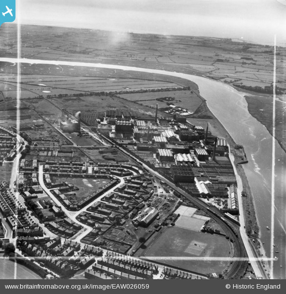
EAW026059 ENGLAND (1949). The Lune Mills and environs, Lancaster, from the east, 1949. This image has been produced from a print marked by Aerofilms Ltd for photo editing.
© Copyright OpenStreetMap contributors and licensed by the OpenStreetMap Foundation. 2025. Cartography is licensed as CC BY-SA.
Nearby Images (5)
EAW026059

EPW042032

EPW038716
 and environs, Lancaster, from the north-east, 1932")
EAW026061

EPW038709
, Lancaster, from the north-east, 1932")
Details
| Title | [EAW026059] The Lune Mills and environs, Lancaster, from the east, 1949. This image has been produced from a print marked by Aerofilms Ltd for photo editing. |
| Reference | EAW026059 |
| Date | 15-August-1949 |
| Link | |
| Place name | LANCASTER |
| Parish | |
| District | |
| Country | ENGLAND |
| Easting / Northing | 346608, 461986 |
| Longitude / Latitude | -2.8156110110073, 54.050881736205 |
| National Grid Reference | SD466620 |
Pins
Be the first to add a comment to this image!