
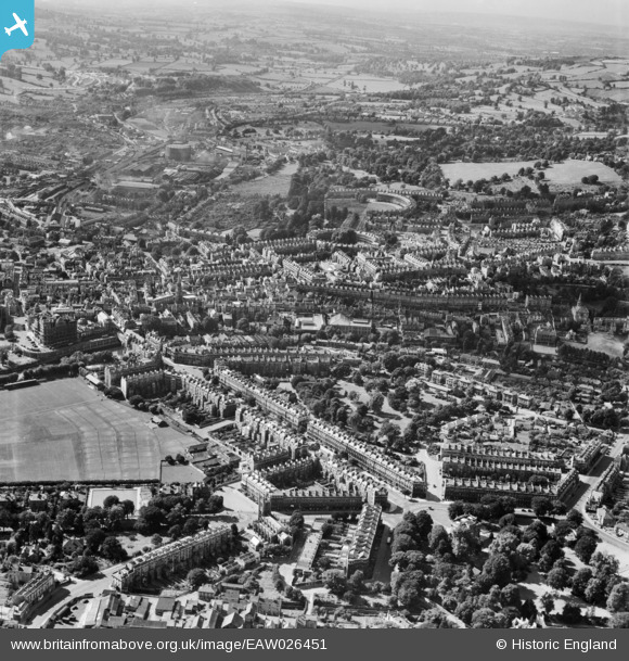
EAW026451 ENGLAND (1949). Henrietta Park and the city centre, Bath, from the east, 1949
© Copyright OpenStreetMap contributors and licensed by the OpenStreetMap Foundation. 2025. Cartography is licensed as CC BY-SA.
Nearby Images (12)
EAW026451

EAW000751

EAW000750

EAW000753

EPW001954

EAW000752

EAW049900

EPW048377

EAW049899

EPW001955

EAW049901

EPW048402

Details
| Title | [EAW026451] Henrietta Park and the city centre, Bath, from the east, 1949 |
| Reference | EAW026451 |
| Date | 8-September-1949 |
| Link | |
| Place name | BATH |
| Parish | |
| District | |
| Country | ENGLAND |
| Easting / Northing | 375462, 165146 |
| Longitude / Latitude | -2.3526510561635, 51.384332586626 |
| National Grid Reference | ST755651 |
Pins
 Class31 |
Wednesday 5th of March 2014 11:58:43 AM | |
Class31 |
Wednesday 5th of March 2014 11:54:59 AM | |
 MB |
Wednesday 5th of March 2014 11:48:42 AM | |
MB |
Wednesday 5th of March 2014 11:46:53 AM | |
MB |
Wednesday 5th of March 2014 11:45:54 AM | |
MB |
Wednesday 5th of March 2014 11:45:33 AM | |
MB |
Wednesday 5th of March 2014 11:45:07 AM | |
MB |
Wednesday 5th of March 2014 11:43:20 AM |

