
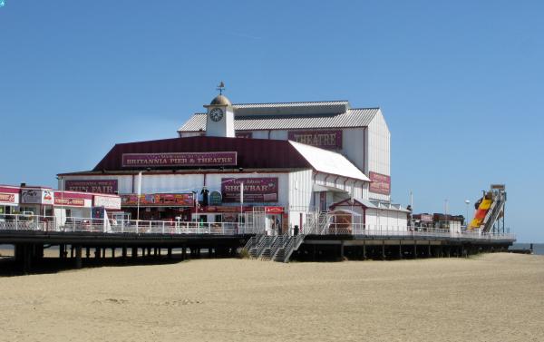
EAW026624 ENGLAND (1949). Britannia Pier and the beach, Great Yarmouth, from the south-east, 1949

© Copyright OpenStreetMap contributors and licensed by the OpenStreetMap Foundation. 2025. Cartography is licensed as CC BY-SA.
Nearby Images (10)
EAW026624

EAW045614

EAW005071

EPW021186

EAW045607

EAW005072

EAW026623

EAW045609

EAW045612

EPW021196

Details
| Title | [EAW026624] Britannia Pier and the beach, Great Yarmouth, from the south-east, 1949 |
| Reference | EAW026624 |
| Date | 16-September-1949 |
| Link | |
| Place name | GREAT YARMOUTH |
| Parish | |
| District | |
| Country | ENGLAND |
| Easting / Northing | 653393, 307613 |
| Longitude / Latitude | 1.7429119816404, 52.606727348018 |
| National Grid Reference | TG534076 |
Pins
 redmist |
Sunday 16th of January 2022 08:53:47 PM | |
redmist |
Sunday 16th of January 2022 08:52:09 PM | |
redmist |
Sunday 16th of January 2022 08:43:36 PM | |
 Alan McFaden |
Sunday 31st of August 2014 10:59:38 AM | |
pebble |
Tuesday 18th of February 2014 12:06:14 PM | |
pebble |
Tuesday 18th of February 2014 12:05:21 PM |
User Comment Contributions
 View North from the Pier |
Alan McFaden |
Sunday 31st of August 2014 11:00:12 AM |
Hills Marine View hotel on the corner of Euston Road still looks as if it is in a bombed out condition. |
pebble |
Tuesday 18th of February 2014 12:03:18 PM |