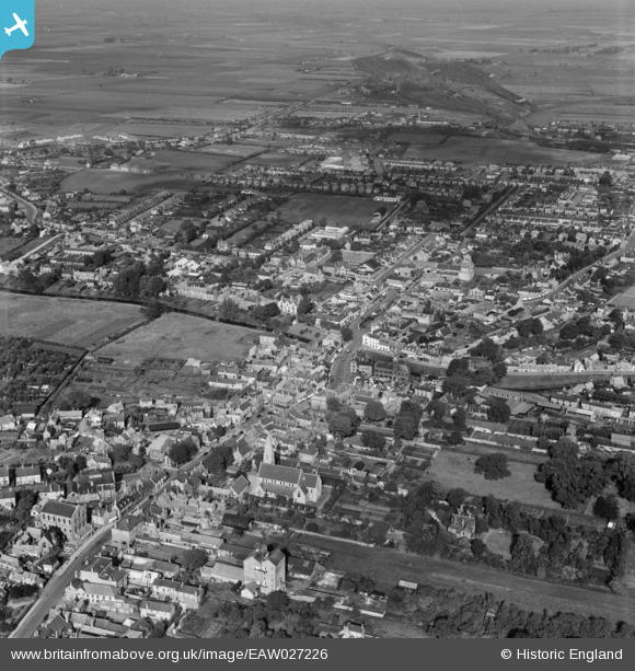
EAW027226 ENGLAND (1949). St Peter's Church, Broad Street and the town centre, March, 1949
© Copyright OpenStreetMap contributors and licensed by the OpenStreetMap Foundation. 2025. Cartography is licensed as CC BY-SA.
Nearby Images (8)
Details
| Title | [EAW027226] St Peter's Church, Broad Street and the town centre, March, 1949 |
| Reference | EAW027226 |
| Date | 12-October-1949 |
| Link | |
| Place name | MARCH |
| Parish | MARCH |
| District | |
| Country | ENGLAND |
| Easting / Northing | 541631, 296761 |
| Longitude / Latitude | 0.089082565029789, 52.549882566258 |
| National Grid Reference | TL416968 |


![[EAW027226] St Peter's Church, Broad Street and the town centre, March, 1949](http://britainfromabove.org.uk/sites/all/libraries/aerofilms-images/public/100x100/EAW/027/EAW027226.jpg)
![[EAW027225] St Peter's Church, Broad Street and the town centre, March, 1949](http://britainfromabove.org.uk/sites/all/libraries/aerofilms-images/public/100x100/EAW/027/EAW027225.jpg)
![[EAW027227] The town centre, March, 1949](http://britainfromabove.org.uk/sites/all/libraries/aerofilms-images/public/100x100/EAW/027/EAW027227.jpg)
![[EAW027229A] The Town Hall, Broad Street and the town centre, March, 1949](http://britainfromabove.org.uk/sites/all/libraries/aerofilms-images/public/100x100/EAW/027/EAW027229A.jpg)
![[EPW013054] The Market Place, March, 1925. This image has been produced from a copy-negative.](http://britainfromabove.org.uk/sites/all/libraries/aerofilms-images/public/100x100/EPW/013/EPW013054.jpg)
![[EAW027224] The Market Place and the town centre, March, 1949](http://britainfromabove.org.uk/sites/all/libraries/aerofilms-images/public/100x100/EAW/027/EAW027224.jpg)
![[EAW027229] The Market Place and Town Hall, March, 1949](http://britainfromabove.org.uk/sites/all/libraries/aerofilms-images/public/100x100/EAW/027/EAW027229.jpg)
![[EAW027228] The town centre and the River Nene (old course), March, 1949](http://britainfromabove.org.uk/sites/all/libraries/aerofilms-images/public/100x100/EAW/027/EAW027228.jpg)
