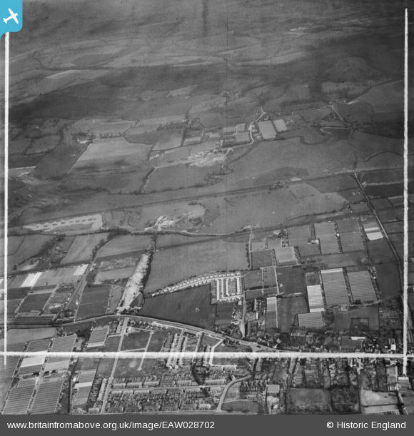
EAW028702 ENGLAND (1950). Gravel workings along the River Lea (or Lee) Navigation, Cheshunt, 1950. This image was marked by Aerofilms Ltd for photo editing.
© Copyright OpenStreetMap contributors and licensed by the OpenStreetMap Foundation. 2025. Cartography is licensed as CC BY-SA.
Details
| Title | [EAW028702] Gravel workings along the River Lea (or Lee) Navigation, Cheshunt, 1950. This image was marked by Aerofilms Ltd for photo editing. |
| Reference | EAW028702 |
| Date | 20-April-1950 |
| Link | |
| Place name | CHESHUNT |
| Parish | |
| District | |
| Country | ENGLAND |
| Easting / Northing | 537069, 203428 |
| Longitude / Latitude | -0.015788837533005, 51.712356327106 |
| National Grid Reference | TL371034 |
Pins
 redmist |
Sunday 27th of February 2022 07:35:59 PM | |
 redmist |
Sunday 27th of February 2022 07:34:50 PM | |
 redmist |
Sunday 27th of February 2022 07:33:20 PM | |
 redmist |
Sunday 27th of February 2022 07:31:44 PM | |
 Gorlestonspur |
Thursday 19th of December 2019 09:29:28 PM | |
 robert |
Friday 17th of May 2019 01:30:45 AM | |
 Grk |
Sunday 20th of September 2015 04:48:56 PM | |
 Grk |
Sunday 20th of September 2015 04:47:42 PM |


![[EAW028702] Gravel workings along the River Lea (or Lee) Navigation, Cheshunt, 1950. This image was marked by Aerofilms Ltd for photo editing.](http://britainfromabove.org.uk/sites/all/libraries/aerofilms-images/public/100x100/EAW/028/EAW028702.jpg)
![[EAW028701] Gravel workings along the River Lea (or Lee) Navigation, Cheshunt, 1950. This image was marked by Aerofilms Ltd for photo editing.](http://britainfromabove.org.uk/sites/all/libraries/aerofilms-images/public/100x100/EAW/028/EAW028701.jpg)
![[EAW028703] Gravel workings along the River Lea (or Lee) Navigation, Waltham Abbey, 1950. This image was marked by Aerofilms Ltd for photo editing.](http://britainfromabove.org.uk/sites/all/libraries/aerofilms-images/public/100x100/EAW/028/EAW028703.jpg)
![[EAW028706] Gravel workings along the River Lea (or Lee) Navigation, Cheshunt, 1950. This image was marked by Aerofilms Ltd for photo editing.](http://britainfromabove.org.uk/sites/all/libraries/aerofilms-images/public/100x100/EAW/028/EAW028706.jpg)