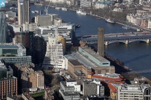
EAW028765 ENGLAND (1950). Suffolk Street, Sumner Street and environs, The Borough, 1950. This image was marked by Aerofilms Ltd for photo editing.
© Copyright OpenStreetMap contributors and licensed by the OpenStreetMap Foundation. 2025. Cartography is licensed as CC BY-SA.
Nearby Images (20)
Details
| Title | [EAW028765] Suffolk Street, Sumner Street and environs, The Borough, 1950. This image was marked by Aerofilms Ltd for photo editing. |
| Reference | EAW028765 |
| Date | 20-April-1950 |
| Link | |
| Place name | THE BOROUGH |
| Parish | |
| District | |
| Country | ENGLAND |
| Easting / Northing | 531907, 180304 |
| Longitude / Latitude | -0.099170941045816, 51.505770312188 |
| National Grid Reference | TQ319803 |
Pins
 Alan McFaden |
Monday 16th of June 2014 11:02:21 AM | |
 Alan McFaden |
Monday 28th of April 2014 12:36:22 PM | |
 Alan McFaden |
Friday 28th of February 2014 10:39:57 AM |


![[EAW028765] Suffolk Street, Sumner Street and environs, The Borough, 1950. This image was marked by Aerofilms Ltd for photo editing.](http://britainfromabove.org.uk/sites/all/libraries/aerofilms-images/public/100x100/EAW/028/EAW028765.jpg)
![[EAW028764] Southwark Street from Great Guildford Street to Hopton Street, The Borough, 1950. This image was marked by Aerofilms Ltd for photo editing.](http://britainfromabove.org.uk/sites/all/libraries/aerofilms-images/public/100x100/EAW/028/EAW028764.jpg)
![[EAW028768] The area around Southwark Street between Blackfriars Road and Southwark Bridge Road, The Borough, 1950. This image was marked by Aerofilms Ltd for photo editing.](http://britainfromabove.org.uk/sites/all/libraries/aerofilms-images/public/100x100/EAW/028/EAW028768.jpg)
![[EAW028770] Southwark Street, Bankside Power Station under construction and environs, The Borough, 1950. This image was marked by Aerofilms Ltd for photo editing.](http://britainfromabove.org.uk/sites/all/libraries/aerofilms-images/public/100x100/EAW/028/EAW028770.jpg)
![[EAW028771] Southwark Street, Blackfriars Bridge and environs, The Borough, 1950. This image was marked by Aerofilms Ltd for photo editing.](http://britainfromabove.org.uk/sites/all/libraries/aerofilms-images/public/100x100/EAW/028/EAW028771.jpg)
![[EAW028769] Great Suffolk Street and environs, The Borough, 1950. This image was marked by Aerofilms Ltd for photo editing.](http://britainfromabove.org.uk/sites/all/libraries/aerofilms-images/public/100x100/EAW/028/EAW028769.jpg)
![[EAW043631] Bankside Power Station under construction and the surrounding area, The Borough, 1952](http://britainfromabove.org.uk/sites/all/libraries/aerofilms-images/public/100x100/EAW/043/EAW043631.jpg)
![[EAW028767] Southwark Street from Great Guildford Street to Hopton Street, The Borough, 1950. This image was marked by Aerofilms Ltd for photo editing.](http://britainfromabove.org.uk/sites/all/libraries/aerofilms-images/public/100x100/EAW/028/EAW028767.jpg)
![[EAW041953] Bankside Power Station under construction, The Borough, 1952](http://britainfromabove.org.uk/sites/all/libraries/aerofilms-images/public/100x100/EAW/041/EAW041953.jpg)
![[EAW028772] Bankside Power Station under construction and environs, The Borough, 1950. This image was marked by Aerofilms Ltd for photo editing.](http://britainfromabove.org.uk/sites/all/libraries/aerofilms-images/public/100x100/EAW/028/EAW028772.jpg)
![[EAW028773] The Ewer Street Grand Vitesse Depot, Lavington Street, Southwark Street and environs, The Borough, 1950. This image was marked by Aerofilms Ltd for photo editing.](http://britainfromabove.org.uk/sites/all/libraries/aerofilms-images/public/100x100/EAW/028/EAW028773.jpg)
![[EAW043634] Bankside Power Station under construction and Blackfriars Bridge, The Borough, 1952](http://britainfromabove.org.uk/sites/all/libraries/aerofilms-images/public/100x100/EAW/043/EAW043634.jpg)
![[EAW041955] Bankside Power Station under construction, The Borough, 1952](http://britainfromabove.org.uk/sites/all/libraries/aerofilms-images/public/100x100/EAW/041/EAW041955.jpg)
![[EAW041951] Bankside Power Station under construction, The Borough, 1952](http://britainfromabove.org.uk/sites/all/libraries/aerofilms-images/public/100x100/EAW/041/EAW041951.jpg)
![[EAW028766] The Ewer Street Grand Vitesse Depot, Lavington Street, Southwark Street and environs, The Borough, 1950. This image was marked by Aerofilms Ltd for photo editing.](http://britainfromabove.org.uk/sites/all/libraries/aerofilms-images/public/100x100/EAW/028/EAW028766.jpg)
![[EAW041952] Bankside Power Station under construction, The Borough, 1952](http://britainfromabove.org.uk/sites/all/libraries/aerofilms-images/public/100x100/EAW/041/EAW041952.jpg)
![[EAW041954] Bankside Power Station under construction, The Borough, 1952](http://britainfromabove.org.uk/sites/all/libraries/aerofilms-images/public/100x100/EAW/041/EAW041954.jpg)
![[EAW043633] Bankside Power Station under construction and the surrounding area, The Borough, 1952](http://britainfromabove.org.uk/sites/all/libraries/aerofilms-images/public/100x100/EAW/043/EAW043633.jpg)
![[EPW060802] Lambeth, Bermondsey and the River Thames from Westminster Bridge to London Bridge, London, 1939](http://britainfromabove.org.uk/sites/all/libraries/aerofilms-images/public/100x100/EPW/060/EPW060802.jpg)
![[EAW043632] Bankside Power Station under construction and Blackfriars Bridge, The Borough, 1952](http://britainfromabove.org.uk/sites/all/libraries/aerofilms-images/public/100x100/EAW/043/EAW043632.jpg)


