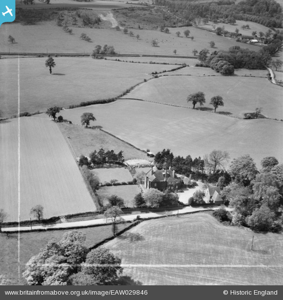
EAW029846 ENGLAND (1950). Red Court, Butterton, 1950. This image was marked by Aerofilms Ltd for photo editing.
© Copyright OpenStreetMap contributors and licensed by the OpenStreetMap Foundation. 2024. Cartography is licensed as CC BY-SA.
Nearby Images (7)
Details
| Title | [EAW029846] Red Court, Butterton, 1950. This image was marked by Aerofilms Ltd for photo editing. |
| Reference | EAW029846 |
| Date | 23-May-1950 |
| Link | |
| Place name | BUTTERTON |
| Parish | WHITMORE |
| District | |
| Country | ENGLAND |
| Easting / Northing | 382934, 342747 |
| Longitude / Latitude | -2.2542134800175, 52.981483999682 |
| National Grid Reference | SJ829427 |
Pins
Be the first to add a comment to this image!


![[EAW029846] Red Court, Butterton, 1950. This image was marked by Aerofilms Ltd for photo editing.](http://britainfromabove.org.uk/sites/all/libraries/aerofilms-images/public/100x100/EAW/029/EAW029846.jpg)
![[EAW029847] Red Court, Butterton, 1950. This image was marked by Aerofilms Ltd for photo editing.](http://britainfromabove.org.uk/sites/all/libraries/aerofilms-images/public/100x100/EAW/029/EAW029847.jpg)
![[EAW029848] Red Court, Butterton, 1950. This image was marked by Aerofilms Ltd for photo editing.](http://britainfromabove.org.uk/sites/all/libraries/aerofilms-images/public/100x100/EAW/029/EAW029848.jpg)
![[EAW029845] Red Court and environs, Butterton, from the south-west, 1950](http://britainfromabove.org.uk/sites/all/libraries/aerofilms-images/public/100x100/EAW/029/EAW029845.jpg)
![[EAW029843] Red Court, Butterton, 1950](http://britainfromabove.org.uk/sites/all/libraries/aerofilms-images/public/100x100/EAW/029/EAW029843.jpg)
![[EAW029844] Red Court, Butterton, 1950](http://britainfromabove.org.uk/sites/all/libraries/aerofilms-images/public/100x100/EAW/029/EAW029844.jpg)
![[EAW029842] Red Court, Butterton, 1950. This image was marked by Aerofilms Ltd for photo editing.](http://britainfromabove.org.uk/sites/all/libraries/aerofilms-images/public/100x100/EAW/029/EAW029842.jpg)