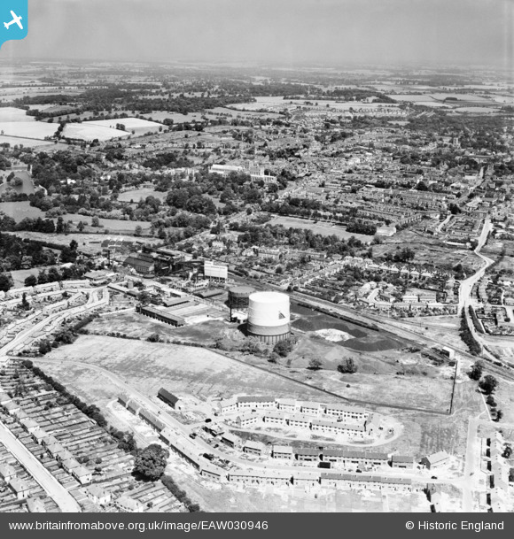
EAW030946 ENGLAND (1950). The Gas Works, construction of new housing at Pemberton Close and the city, St Albans, from the south, 1950
© Copyright OpenStreetMap contributors and licensed by the OpenStreetMap Foundation. 2024. Cartography is licensed as CC BY-SA.
Nearby Images (5)
Details
| Title | [EAW030946] The Gas Works, construction of new housing at Pemberton Close and the city, St Albans, from the south, 1950 |
| Reference | EAW030946 |
| Date | 13-July-1950 |
| Link | |
| Place name | ST ALBANS |
| Parish | |
| District | |
| Country | ENGLAND |
| Easting / Northing | 514633, 205922 |
| Longitude / Latitude | -0.33958984878364, 51.739808064986 |
| National Grid Reference | TL146059 |
Pins
Be the first to add a comment to this image!


![[EAW030946] The Gas Works, construction of new housing at Pemberton Close and the city, St Albans, from the south, 1950](http://britainfromabove.org.uk/sites/all/libraries/aerofilms-images/public/100x100/EAW/030/EAW030946.jpg)
![[EAW030947] The Gas Works and the city, St Albans, from the south, 1950](http://britainfromabove.org.uk/sites/all/libraries/aerofilms-images/public/100x100/EAW/030/EAW030947.jpg)
![[EAW030237] The gas works and city, St Albans, 1950](http://britainfromabove.org.uk/sites/all/libraries/aerofilms-images/public/100x100/EAW/030/EAW030237.jpg)
![[EAW030956] The Gas Works, St Albans, 1950](http://britainfromabove.org.uk/sites/all/libraries/aerofilms-images/public/100x100/EAW/030/EAW030956.jpg)
![[EAW030950] The Gas Works and the city, St Albans, from the south-west, 1950](http://britainfromabove.org.uk/sites/all/libraries/aerofilms-images/public/100x100/EAW/030/EAW030950.jpg)