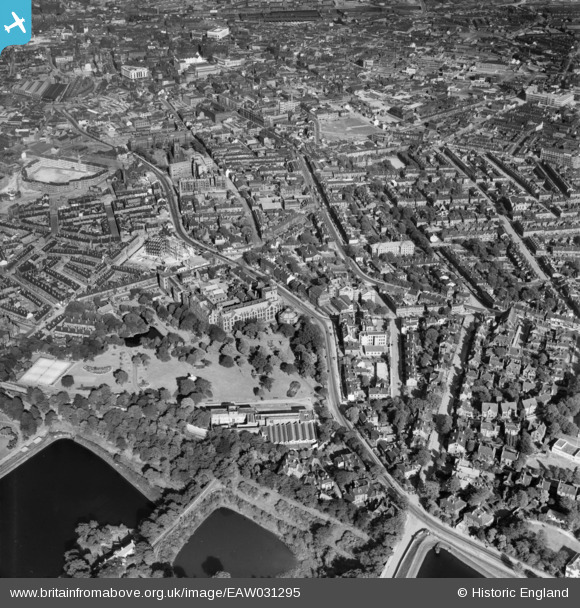
EAW031295 ENGLAND (1950). Weston Park, the University and the city, Sheffield, 1950
© Copyright OpenStreetMap contributors and licensed by the OpenStreetMap Foundation. 2025. Cartography is licensed as CC BY-SA.
Nearby Images (5)
Details
| Title | [EAW031295] Weston Park, the University and the city, Sheffield, 1950 |
| Reference | EAW031295 |
| Date | 26-July-1950 |
| Link | |
| Place name | SHEFFIELD |
| Parish | |
| District | |
| Country | ENGLAND |
| Easting / Northing | 434118, 387243 |
| Longitude / Latitude | -1.4870395788003, 53.380670269212 |
| National Grid Reference | SK341872 |
Pins
 aardvark |
Saturday 30th of October 2021 02:40:18 PM | |
 Chris Kolonko |
Tuesday 12th of September 2017 09:37:19 PM | |
 RichardL |
Wednesday 22nd of October 2014 01:08:58 PM | |
 RichardL |
Wednesday 22nd of October 2014 01:03:49 PM | |
 RichardL |
Wednesday 22nd of October 2014 01:03:14 PM | |
 RichardL |
Wednesday 22nd of October 2014 01:02:25 PM | |
 RichardL |
Wednesday 22nd of October 2014 01:01:45 PM |


![[EAW031295] Weston Park, the University and the city, Sheffield, 1950](http://britainfromabove.org.uk/sites/all/libraries/aerofilms-images/public/100x100/EAW/031/EAW031295.jpg)
![[EAW031297] Weston Park, the University and the city, Sheffield, 1950](http://britainfromabove.org.uk/sites/all/libraries/aerofilms-images/public/100x100/EAW/031/EAW031297.jpg)
![[EAW031298] Weston Park, the University and the city, Sheffield, 1950](http://britainfromabove.org.uk/sites/all/libraries/aerofilms-images/public/100x100/EAW/031/EAW031298.jpg)
![[EPW005949] Weston Park and the University of Sheffield, Sheffield, 1921](http://britainfromabove.org.uk/sites/all/libraries/aerofilms-images/public/100x100/EPW/005/EPW005949.jpg)
![[EAW031296] Weston Park, the University and the city, Sheffield, 1950](http://britainfromabove.org.uk/sites/all/libraries/aerofilms-images/public/100x100/EAW/031/EAW031296.jpg)