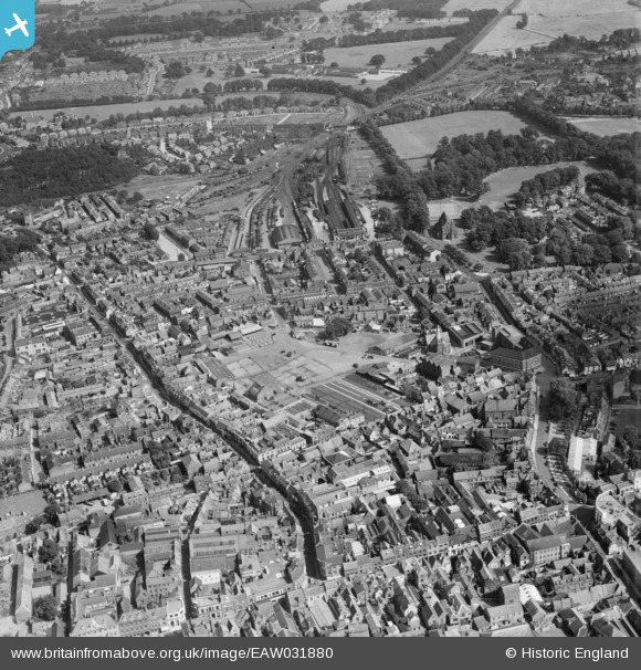
EAW031880 ENGLAND (1950). The town centre, King's Lynn, 1950
© Copyright OpenStreetMap contributors and licensed by the OpenStreetMap Foundation. 2025. Cartography is licensed as CC BY-SA.
Details
| Title | [EAW031880] The town centre, King's Lynn, 1950 |
| Reference | EAW031880 |
| Date | 14-August-1950 |
| Link | |
| Place name | KING'S LYNN |
| Parish | |
| District | |
| Country | ENGLAND |
| Easting / Northing | 562071, 320126 |
| Longitude / Latitude | 0.40178776917079, 52.754066220255 |
| National Grid Reference | TF621201 |
Pins
 redmist |
Monday 9th of December 2024 08:00:41 PM | |
 magic |
Friday 4th of July 2014 09:39:02 PM | |
 Class31 |
Tuesday 24th of June 2014 03:44:56 PM | |
 Class31 |
Tuesday 24th of June 2014 03:43:16 PM | |
 Class31 |
Tuesday 24th of June 2014 03:42:15 PM | |
 Class31 |
Tuesday 24th of June 2014 03:41:32 PM | |
 Class31 |
Tuesday 24th of June 2014 03:22:22 PM | |
 Class31 |
Tuesday 24th of June 2014 03:20:36 PM | |
 Class31 |
Tuesday 24th of June 2014 03:18:28 PM | |
 Class31 |
Tuesday 24th of June 2014 03:15:15 PM | |
 Class31 |
Tuesday 24th of June 2014 02:03:11 PM | |
 Class31 |
Tuesday 24th of June 2014 02:01:39 PM | |
 Class31 |
Tuesday 24th of June 2014 02:00:59 PM |


![[EAW031880] The town centre, King's Lynn, 1950](http://britainfromabove.org.uk/sites/all/libraries/aerofilms-images/public/100x100/EAW/031/EAW031880.jpg)
![[EAW031883] The town centre, King's Lynn, 1950](http://britainfromabove.org.uk/sites/all/libraries/aerofilms-images/public/100x100/EAW/031/EAW031883.jpg)