
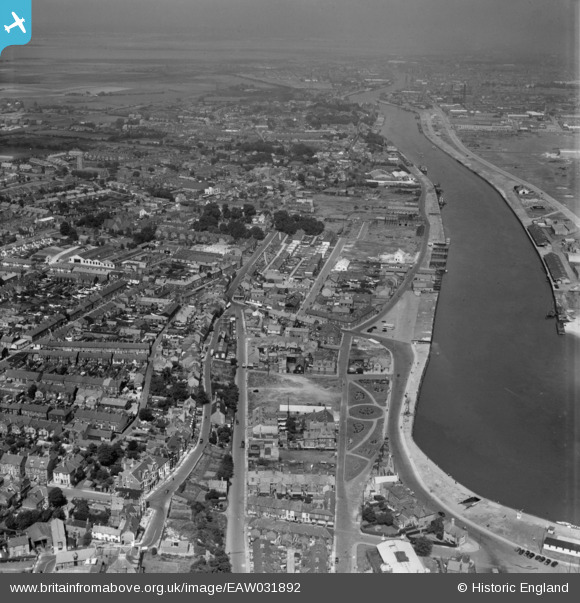
EAW031892 ENGLAND (1950). The River Yare, Great Yarmouth, from the south, 1950
© Copyright OpenStreetMap contributors and licensed by the OpenStreetMap Foundation. 2025. Cartography is licensed as CC BY-SA.
Nearby Images (6)
EAW031892

EPW007011

EPW007008

EAW031891

EPW007010

EPW007005

Details
| Title | [EAW031892] The River Yare, Great Yarmouth, from the south, 1950 |
| Reference | EAW031892 |
| Date | 14-August-1950 |
| Link | |
| Place name | GREAT YARMOUTH |
| Parish | |
| District | |
| Country | ENGLAND |
| Easting / Northing | 652926, 303742 |
| Longitude / Latitude | 1.7330732714229, 52.572215337195 |
| National Grid Reference | TG529037 |
Pins
 redmist |
Tuesday 18th of January 2022 05:02:25 PM | |
redmist |
Tuesday 18th of January 2022 04:59:40 PM | |
redmist |
Tuesday 18th of January 2022 04:57:38 PM |