
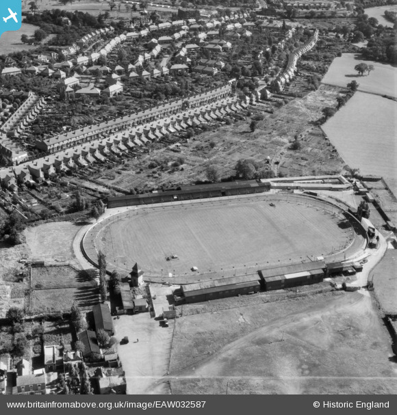
EAW032587 ENGLAND (1950). Kings Heath Greyhound Track and May Lane, Brandwood End, 1950. This image was marked by Aerofilms Ltd for photo editing.
© Copyright OpenStreetMap contributors and licensed by the OpenStreetMap Foundation. 2025. Cartography is licensed as CC BY-SA.
Nearby Images (13)
EAW032587

EAW032586

EAW032592

EAW032588

EAW032593

EPW027016

EAW032591

EAW032589

EAW032597

EAW032595

EAW032590

EAW032594

EAW032596

Details
| Title | [EAW032587] Kings Heath Greyhound Track and May Lane, Brandwood End, 1950. This image was marked by Aerofilms Ltd for photo editing. |
| Reference | EAW032587 |
| Date | 18-September-1950 |
| Link | |
| Place name | BRANDWOOD END |
| Parish | |
| District | |
| Country | ENGLAND |
| Easting / Northing | 407662, 280263 |
| Longitude / Latitude | -1.8873231570217, 52.419928949074 |
| National Grid Reference | SP077803 |
Pins
 Neil |
Sunday 31st of October 2021 01:13:38 AM | |
Neil |
Sunday 31st of October 2021 01:12:30 AM | |
Neil |
Sunday 31st of October 2021 01:11:30 AM | |
Neil |
Sunday 31st of October 2021 01:10:33 AM | |
Neil |
Sunday 31st of October 2021 01:10:00 AM |
User Comment Contributions
1950's brandwood |
haggie64 |
Wednesday 2nd of July 2014 02:19:43 PM |