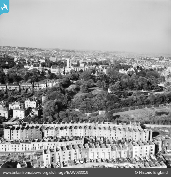
EAW033319 ENGLAND (1950). Clifton Wood and St Andrew's Church, Bristol, from the south, 1950
© Copyright OpenStreetMap contributors and licensed by the OpenStreetMap Foundation. 2025. Cartography is licensed as CC BY-SA.
Details
| Title | [EAW033319] Clifton Wood and St Andrew's Church, Bristol, from the south, 1950 |
| Reference | EAW033319 |
| Date | 5-October-1950 |
| Link | |
| Place name | BRISTOL |
| Parish | |
| District | |
| Country | ENGLAND |
| Easting / Northing | 357316, 172630 |
| Longitude / Latitude | -2.6143274570559, 51.450554700084 |
| National Grid Reference | ST573726 |
Pins
 j_gorecki |
Tuesday 31st of January 2023 08:26:53 PM | |
 Class31 |
Friday 2nd of May 2014 11:48:48 AM |


![[EAW033319] Clifton Wood and St Andrew's Church, Bristol, from the south, 1950](http://britainfromabove.org.uk/sites/all/libraries/aerofilms-images/public/100x100/EAW/033/EAW033319.jpg)
![[EAW033322] Clifton Wood and the city, Bristol, from the south, 1950](http://britainfromabove.org.uk/sites/all/libraries/aerofilms-images/public/100x100/EAW/033/EAW033322.jpg)
![[EPW033499] Clifton Wood and the Clfton Suspension Bridge, Clifton, from the south-east, 1930. This image has been produced from a damaged negative.](http://britainfromabove.org.uk/sites/all/libraries/aerofilms-images/public/100x100/EPW/033/EPW033499.jpg)
![[EAW033316] HMS Flying Fox (Royal Naval Reserve) moored off Hotwell Road, Bristol, 1950](http://britainfromabove.org.uk/sites/all/libraries/aerofilms-images/public/100x100/EAW/033/EAW033316.jpg)