
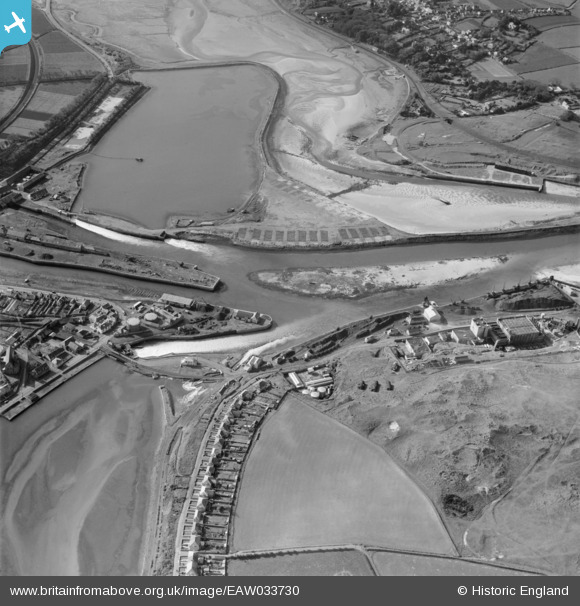
EAW033730 ENGLAND (1950). The harbour, Hayle, 1950
© Copyright OpenStreetMap contributors and licensed by the OpenStreetMap Foundation. 2025. Cartography is licensed as CC BY-SA.
Nearby Images (21)
EAW033730

EAW033731

EAW033735

EAW030942

EAW030936

EAW033734

EAW033739

EAW007752

EAW033733

EAW033732

EAW033741

EAW033737

EAW007760

EPW059856

EAW030935

EAW033738

EAW007761

EAW033740

EAW007753

EAW007758

EAW033736

Details
| Title | [EAW033730] The harbour, Hayle, 1950 |
| Reference | EAW033730 |
| Date | 16-October-1950 |
| Link | |
| Place name | HAYLE |
| Parish | HAYLE |
| District | |
| Country | ENGLAND |
| Easting / Northing | 155572, 37684 |
| Longitude / Latitude | -5.424670160368, 50.188026799594 |
| National Grid Reference | SW556377 |
Pins
 redmist |
Wednesday 15th of July 2020 01:02:56 PM | |
redmist |
Wednesday 15th of July 2020 01:01:56 PM | |
redmist |
Wednesday 15th of July 2020 01:01:32 PM | |
redmist |
Wednesday 15th of July 2020 01:01:00 PM | |
redmist |
Wednesday 15th of July 2020 01:00:11 PM | |
redmist |
Wednesday 15th of July 2020 12:57:57 PM | |
Kevin |
Tuesday 17th of September 2019 04:02:07 PM |