
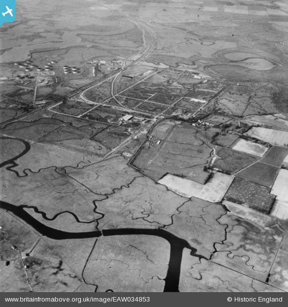
EAW034853 ENGLAND (1951). The Anglo-Iranian Oil Co oil refinery under construction, Isle of Grain, 1951. This image has been produced from a print.
© Copyright OpenStreetMap contributors and licensed by the OpenStreetMap Foundation. 2025. Cartography is licensed as CC BY-SA.
Nearby Images (3)
EAW034853

EAW039858

EAW039852

Details
| Title | [EAW034853] The Anglo-Iranian Oil Co oil refinery under construction, Isle of Grain, 1951. This image has been produced from a print. |
| Reference | EAW034853 |
| Date | 7-March-1951 |
| Link | |
| Place name | ISLE OF GRAIN |
| Parish | ISLE OF GRAIN |
| District | |
| Country | ENGLAND |
| Easting / Northing | 587655, 175221 |
| Longitude / Latitude | 0.70066078338088, 51.44435282645 |
| National Grid Reference | TQ877752 |
Pins
 redmist |
Sunday 23rd of January 2022 09:22:37 PM | |
redmist |
Sunday 23rd of January 2022 09:19:41 PM | |
redmist |
Sunday 23rd of January 2022 09:19:04 PM | |
redmist |
Sunday 23rd of January 2022 09:18:28 PM |