
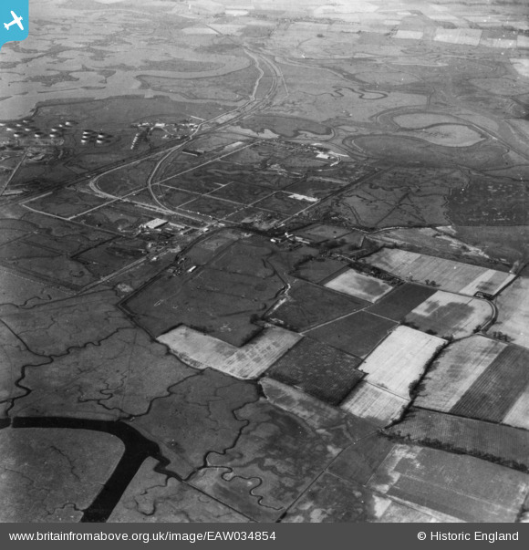
EAW034854 ENGLAND (1951). The Anglo-Iranian Oil Co oil refinery under construction, Isle of Grain, 1951. This image has been produced from a print.
© Copyright OpenStreetMap contributors and licensed by the OpenStreetMap Foundation. 2025. Cartography is licensed as CC BY-SA.
Nearby Images (4)
EAW034854

EAW039856

EAW048526

EAW039857

Details
| Title | [EAW034854] The Anglo-Iranian Oil Co oil refinery under construction, Isle of Grain, 1951. This image has been produced from a print. |
| Reference | EAW034854 |
| Date | 7-March-1951 |
| Link | |
| Place name | ISLE OF GRAIN |
| Parish | ISLE OF GRAIN |
| District | |
| Country | ENGLAND |
| Easting / Northing | 587547, 175511 |
| Longitude / Latitude | 0.69926203398843, 51.446993556476 |
| National Grid Reference | TQ875755 |
Pins
 redmist |
Sunday 23rd of January 2022 09:25:08 PM | |
redmist |
Sunday 23rd of January 2022 09:24:36 PM | |
redmist |
Sunday 23rd of January 2022 09:24:15 PM | |
redmist |
Sunday 23rd of January 2022 09:23:38 PM |