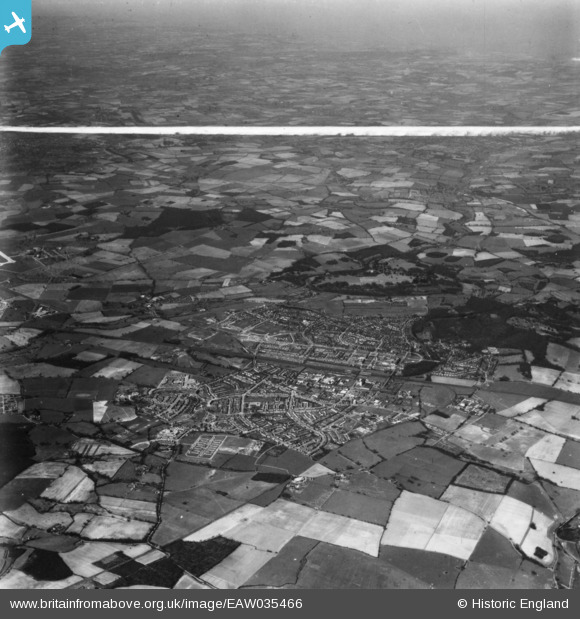
EAW035466 ENGLAND (1951). The town and surrounding countryside, Welwyn Garden City, from the east, 1951. This image has been produced from a print marked by Aerofilms Ltd for photo editing.
© Copyright OpenStreetMap contributors and licensed by the OpenStreetMap Foundation. 2025. Cartography is licensed as CC BY-SA.
Details
| Title | [EAW035466] The town and surrounding countryside, Welwyn Garden City, from the east, 1951. This image has been produced from a print marked by Aerofilms Ltd for photo editing. |
| Reference | EAW035466 |
| Date | 17-April-1951 |
| Link | |
| Place name | WELWYN GARDEN CITY |
| Parish | |
| District | |
| Country | ENGLAND |
| Easting / Northing | 525141, 212435 |
| Longitude / Latitude | -0.18511796337249, 51.79609600183 |
| National Grid Reference | TL251124 |


![[EAW035466] The town and surrounding countryside, Welwyn Garden City, from the east, 1951. This image has been produced from a print marked by Aerofilms Ltd for photo editing.](http://britainfromabove.org.uk/sites/all/libraries/aerofilms-images/public/100x100/EAW/035/EAW035466.jpg)
![[EPW047372] Housing around Cranborne Gardens and Shortlands Green, Welwyn Garden City, 1935](http://britainfromabove.org.uk/sites/all/libraries/aerofilms-images/public/100x100/EPW/047/EPW047372.jpg)
![[EPW047373] Housing around Cranborne Gardens, Shortlands Green and environs, Welwyn Garden City, 1935](http://britainfromabove.org.uk/sites/all/libraries/aerofilms-images/public/100x100/EPW/047/EPW047373.jpg)
