
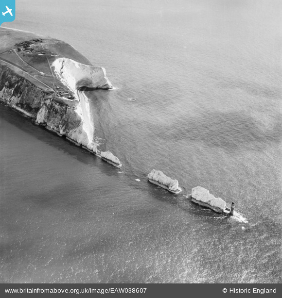
EAW038607 ENGLAND (1951). The Needles and Scratchell's Bay, Isle of Wight, 1951
© Copyright OpenStreetMap contributors and licensed by the OpenStreetMap Foundation. 2025. Cartography is licensed as CC BY-SA.
Nearby Images (16)
EAW038607

EAW038605

EAW002997

EAW015258

EAW038604

EAW038608

EAW015259

EAW022203

EAW038606

EPW022903

EPW022899

EPW000793

EAW022202

EPW022902

EPW022901

EPW000478

Details
| Title | [EAW038607] The Needles and Scratchell's Bay, Isle of Wight, 1951 |
| Reference | EAW038607 |
| Date | 13-August-1951 |
| Link | |
| Place name | ISLE OF WIGHT |
| Parish | TOTLAND |
| District | |
| Country | ENGLAND |
| Easting / Northing | 429266, 84830 |
| Longitude / Latitude | -1.5858871098337, 50.661826405185 |
| National Grid Reference | SZ293848 |
Pins
Be the first to add a comment to this image!