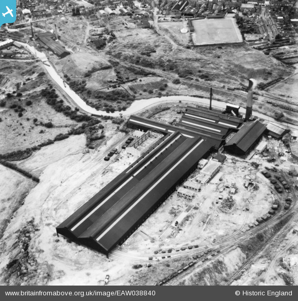
EAW038840 ENGLAND (1951). The Old Level Works, Brierley Hill, 1951. This image has been produced from a print.
© Copyright OpenStreetMap contributors and licensed by the OpenStreetMap Foundation. 2025. Cartography is licensed as CC BY-SA.
Details
| Title | [EAW038840] The Old Level Works, Brierley Hill, 1951. This image has been produced from a print. |
| Reference | EAW038840 |
| Date | 15-August-1951 |
| Link | |
| Place name | BRIERLEY HILL |
| Parish | |
| District | |
| Country | ENGLAND |
| Easting / Northing | 392357, 287134 |
| Longitude / Latitude | -2.1125548051913, 52.481706614862 |
| National Grid Reference | SO924871 |
Pins
 waynesiverns |
Monday 27th of January 2025 02:34:32 PM | |
 black country history hunter |
Sunday 25th of October 2020 06:49:11 PM | |
 Martin |
Wednesday 4th of February 2015 09:51:41 PM |


![[EAW038840] The Old Level Works, Brierley Hill, 1951. This image has been produced from a print.](http://britainfromabove.org.uk/sites/all/libraries/aerofilms-images/public/100x100/EAW/038/EAW038840.jpg)
![[EAW038841] The Old Level Works, Brierley Hill, 1951. This image has been produced from a print.](http://britainfromabove.org.uk/sites/all/libraries/aerofilms-images/public/100x100/EAW/038/EAW038841.jpg)