
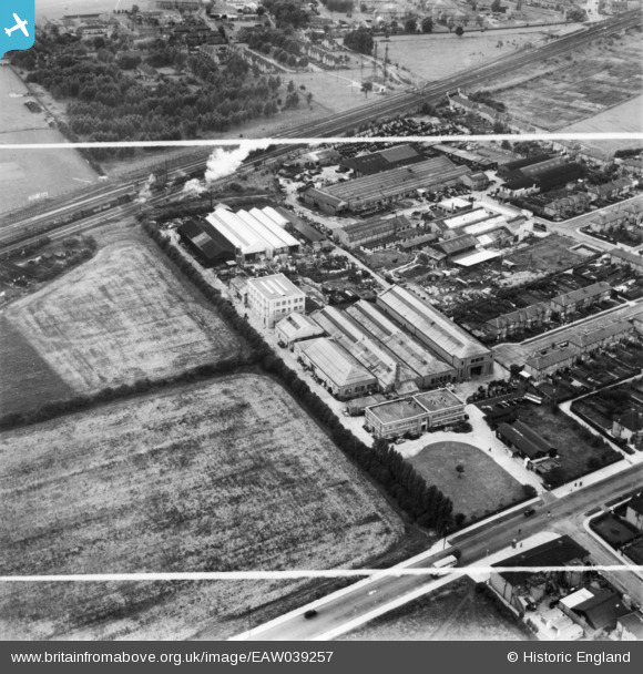
EAW039257 ENGLAND (1951). The Air Control Installation Works, South Ruislip, 1951. This image has been produced from a print marked by Aerofilms Ltd for photo editing.
© Copyright OpenStreetMap contributors and licensed by the OpenStreetMap Foundation. 2025. Cartography is licensed as CC BY-SA.
Nearby Images (10)
EAW039257

EAW039256

EAW039260

EAW039262

EAW039258

EAW039254

EAW039263

EAW039259

EAW039261

EAW039255

Details
| Title | [EAW039257] The Air Control Installation Works, South Ruislip, 1951. This image has been produced from a print marked by Aerofilms Ltd for photo editing. |
| Reference | EAW039257 |
| Date | 31-August-1951 |
| Link | |
| Place name | SOUTH RUISLIP |
| Parish | |
| District | |
| Country | ENGLAND |
| Easting / Northing | 510927, 185722 |
| Longitude / Latitude | -0.39965464490926, 51.558981230329 |
| National Grid Reference | TQ109857 |
Pins
 Matt Aldred edob.mattaldred.com |
Friday 29th of March 2024 05:55:50 PM | |
Matt Aldred edob.mattaldred.com |
Friday 29th of March 2024 05:55:18 PM |