
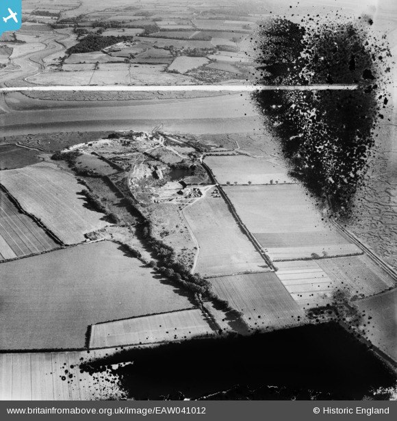
EAW041012 ENGLAND (1951). Freshwater Gravel Pit, Fingringhoe, 1951. This image has been produced from a damaged negative.
© Copyright OpenStreetMap contributors and licensed by the OpenStreetMap Foundation. 2025. Cartography is licensed as CC BY-SA.
Nearby Images (5)
EAW041012

EAW041011

EAW041013

EAW041015

EAW041014

Details
| Title | [EAW041012] Freshwater Gravel Pit, Fingringhoe, 1951. This image has been produced from a damaged negative. |
| Reference | EAW041012 |
| Date | 23-October-1951 |
| Link | |
| Place name | FINGRINGHOE |
| Parish | FINGRINGHOE |
| District | |
| Country | ENGLAND |
| Easting / Northing | 604503, 219400 |
| Longitude / Latitude | 0.96861433480554, 51.835262166548 |
| National Grid Reference | TM045194 |
Pins
Be the first to add a comment to this image!