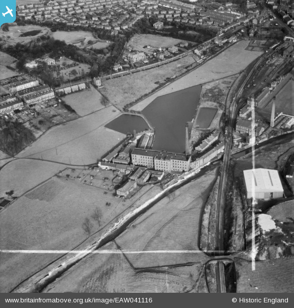
EAW041116 ENGLAND (1951). New Hall Hey Mills, New Hall Hey, 1951. This image was marked by Aerofilms Ltd for photo editing.
© Copyright OpenStreetMap contributors and licensed by the OpenStreetMap Foundation. 2025. Cartography is licensed as CC BY-SA.
Nearby Images (8)
EAW041116

EAW041114

EAW041115

EAW041118

EAW041117

EAW041121

EAW041120

EAW041119

Details
| Title | [EAW041116] New Hall Hey Mills, New Hall Hey, 1951. This image was marked by Aerofilms Ltd for photo editing. |
| Reference | EAW041116 |
| Date | 31-October-1951 |
| Link | |
| Place name | NEW HALL HEY |
| Parish | |
| District | |
| Country | ENGLAND |
| Easting / Northing | 380464, 422361 |
| Longitude / Latitude | -2.2959191974758, 53.697096583727 |
| National Grid Reference | SD805224 |
Pins
 Class31 |
Monday 2nd of February 2015 05:05:38 PM |