
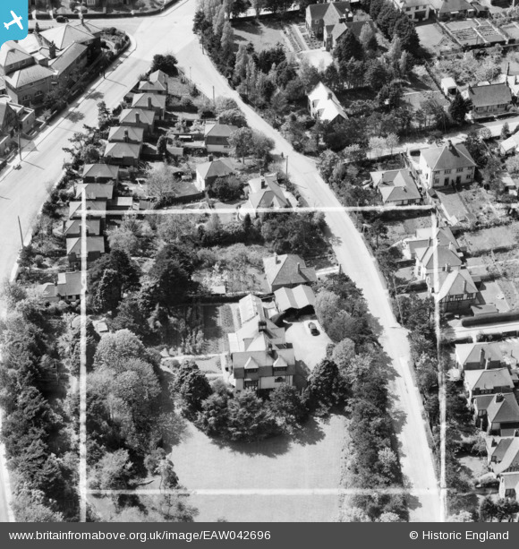
EAW042696 ENGLAND (1952). 32 Kingsdown Park, Tankerton, 1952. This image was marked by Aerofilms Ltd for photo editing.
© Copyright OpenStreetMap contributors and licensed by the OpenStreetMap Foundation. 2025. Cartography is licensed as CC BY-SA.
Nearby Images (10)
EAW042696

EAW042693

EAW042692

EAW042694

EAW042695

EAW042699

EAW042691

EAW042697

EAW042698

EPW018622

Details
| Title | [EAW042696] 32 Kingsdown Park, Tankerton, 1952. This image was marked by Aerofilms Ltd for photo editing. |
| Reference | EAW042696 |
| Date | 25-April-1952 |
| Link | |
| Place name | TANKERTON |
| Parish | |
| District | |
| Country | ENGLAND |
| Easting / Northing | 611624, 166954 |
| Longitude / Latitude | 1.0401896435719, 51.361667767667 |
| National Grid Reference | TR116670 |
Pins
 |
 Billy Turner |
Friday 8th of January 2016 02:44:37 PM |
 |
Billy Turner |
Friday 8th of January 2016 02:19:07 PM |