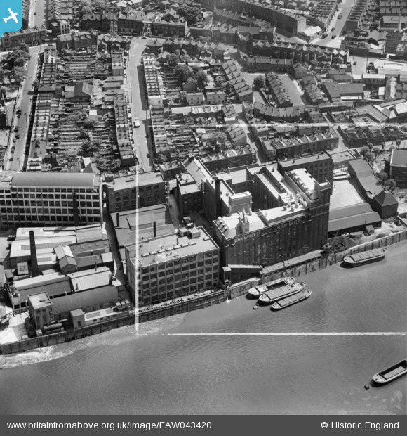
EAW043420 ENGLAND (1952). Battersea Flour Mills, Battersea, 1952. This image was marked by Aerofilms Ltd for photo editing.
© Copyright OpenStreetMap contributors and licensed by the OpenStreetMap Foundation. 2025. Cartography is licensed as CC BY-SA.
Nearby Images (6)
Details
| Title | [EAW043420] Battersea Flour Mills, Battersea, 1952. This image was marked by Aerofilms Ltd for photo editing. |
| Reference | EAW043420 |
| Date | 28-May-1952 |
| Link | |
| Place name | BATTERSEA |
| Parish | |
| District | |
| Country | ENGLAND |
| Easting / Northing | 526854, 176950 |
| Longitude / Latitude | -0.17315157907922, 51.476781833401 |
| National Grid Reference | TQ269770 |
Pins
 Jonsey |
Wednesday 10th of February 2021 09:38:53 PM | |
 Jonsey |
Wednesday 10th of February 2021 09:37:10 PM | |
 Post-war prefabs |
Wednesday 23rd of October 2019 04:17:17 PM | |
 MB |
Monday 3rd of October 2016 01:07:33 PM | |
 Alan McFaden |
Sunday 15th of June 2014 03:47:55 PM |


![[EAW043420] Battersea Flour Mills, Battersea, 1952. This image was marked by Aerofilms Ltd for photo editing.](http://britainfromabove.org.uk/sites/all/libraries/aerofilms-images/public/100x100/EAW/043/EAW043420.jpg)
![[EAW043423] Battersea Flour Mills and St Mary's Church, Battersea, 1952. This image was marked by Aerofilms Ltd for photo editing.](http://britainfromabove.org.uk/sites/all/libraries/aerofilms-images/public/100x100/EAW/043/EAW043423.jpg)
![[EAW043424] Battersea Flour Mills and St Mary's Church, Battersea, 1952. This image was marked by Aerofilms Ltd for photo editing.](http://britainfromabove.org.uk/sites/all/libraries/aerofilms-images/public/100x100/EAW/043/EAW043424.jpg)
![[EAW043422] The River Thames at Battersea Flour Mills and St Mary's Church, Battersea, 1952. This image was marked by Aerofilms Ltd for photo editing.](http://britainfromabove.org.uk/sites/all/libraries/aerofilms-images/public/100x100/EAW/043/EAW043422.jpg)
![[EAW043421] Battersea Flour Mills and St Mary's Church, Battersea, 1952. This image was marked by Aerofilms Ltd for photo editing.](http://britainfromabove.org.uk/sites/all/libraries/aerofilms-images/public/100x100/EAW/043/EAW043421.jpg)
![[EAW009111] The River Thames and environs from Lots Road Power Station to Battersea Power Station, Chelsea, from the south-west, 1947](http://britainfromabove.org.uk/sites/all/libraries/aerofilms-images/public/100x100/EAW/009/EAW009111.jpg)
