
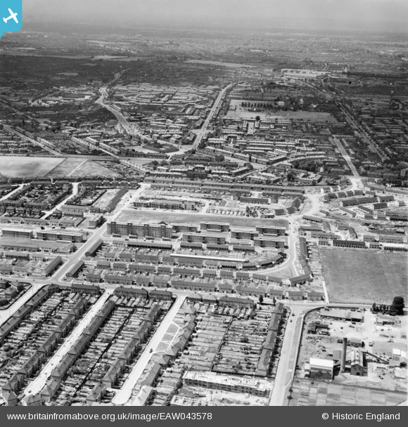
EAW043578 ENGLAND (1952). Part of the Becontree Estate centred upon Listowel Road, Dagenham, from the east, 1952
© Copyright OpenStreetMap contributors and licensed by the OpenStreetMap Foundation. 2025. Cartography is licensed as CC BY-SA.
Nearby Images (3)
EAW043578

EAW043577

EPW046202

Details
| Title | [EAW043578] Part of the Becontree Estate centred upon Listowel Road, Dagenham, from the east, 1952 |
| Reference | EAW043578 |
| Date | 4-June-1952 |
| Link | |
| Place name | DAGENHAM |
| Parish | |
| District | |
| Country | ENGLAND |
| Easting / Northing | 549496, 186387 |
| Longitude / Latitude | 0.15669410408701, 51.556053169349 |
| National Grid Reference | TQ495864 |
Pins
Be the first to add a comment to this image!