
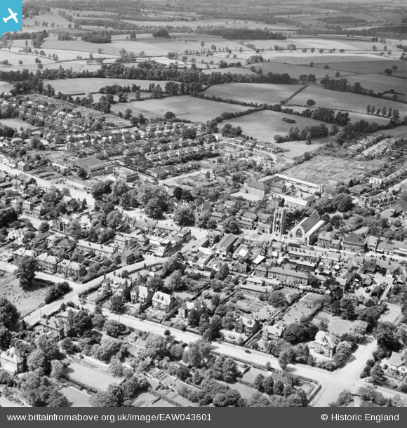
EAW043601 ENGLAND (1952). St John The Baptist's Church, the High Street and town centre, Epping, 1952
© Copyright OpenStreetMap contributors and licensed by the OpenStreetMap Foundation. 2025. Cartography is licensed as CC BY-SA.
Nearby Images (3)
EAW043601

EAW043600

EAW043599

Details
| Title | [EAW043601] St John The Baptist's Church, the High Street and town centre, Epping, 1952 |
| Reference | EAW043601 |
| Date | 4-June-1952 |
| Link | |
| Place name | EPPING |
| Parish | EPPING |
| District | |
| Country | ENGLAND |
| Easting / Northing | 545886, 202028 |
| Longitude / Latitude | 0.1111695695863, 51.697551933226 |
| National Grid Reference | TL459020 |
Pins
 somoody |
Saturday 1st of March 2025 09:21:38 PM | |
somoody |
Saturday 1st of March 2025 09:20:07 PM | |
 Phil |
Sunday 19th of March 2017 08:28:29 AM | |
Blake1 |
Wednesday 15th of February 2017 12:21:01 PM | |
Mikeya |
Thursday 24th of July 2014 03:05:45 PM | |
Mikeya |
Thursday 24th of July 2014 03:05:15 PM |