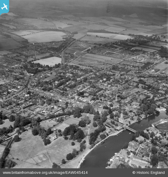
EAW045414 ENGLAND (1952). The town, Marlow, 1952
© Copyright OpenStreetMap contributors and licensed by the OpenStreetMap Foundation. 2025. Cartography is licensed as CC BY-SA.
Details
| Title | [EAW045414] The town, Marlow, 1952 |
| Reference | EAW045414 |
| Date | 6-August-1952 |
| Link | |
| Place name | MARLOW |
| Parish | MARLOW |
| District | |
| Country | ENGLAND |
| Easting / Northing | 485130, 186563 |
| Longitude / Latitude | -0.77151855118401, 51.571026857206 |
| National Grid Reference | SU851866 |
Pins
 misterjohn |
Tuesday 19th of November 2024 03:09:13 PM | |
 misterjohn |
Tuesday 19th of November 2024 03:07:21 PM | |
 misterjohn |
Tuesday 3rd of January 2023 12:59:56 PM | |
 misterjohn |
Tuesday 3rd of January 2023 12:57:20 PM | |
 misterjohn |
Tuesday 3rd of January 2023 12:55:43 PM | |
 misterjohn |
Tuesday 3rd of January 2023 12:54:35 PM | |
 MikeS56 |
Monday 7th of October 2019 05:24:28 PM | |
 bondi |
Monday 7th of December 2015 09:42:24 PM | |
 bondi |
Monday 7th of December 2015 09:42:21 PM | |
 bondi |
Monday 7th of December 2015 09:42:18 PM |


![[EAW045414] The town, Marlow, 1952](http://britainfromabove.org.uk/sites/all/libraries/aerofilms-images/public/100x100/EAW/045/EAW045414.jpg)
![[EAW045415] The town, Marlow, 1952](http://britainfromabove.org.uk/sites/all/libraries/aerofilms-images/public/100x100/EAW/045/EAW045415.jpg)