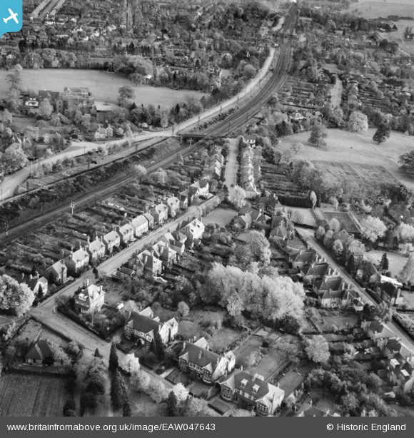
EAW047643 ENGLAND (1952). Tennyson Road, Harpenden, 1952
© Copyright OpenStreetMap contributors and licensed by the OpenStreetMap Foundation. 2025. Cartography is licensed as CC BY-SA.
Nearby Images (8)
Details
| Title | [EAW047643] Tennyson Road, Harpenden, 1952 |
| Reference | EAW047643 |
| Date | 27-October-1952 |
| Link | |
| Place name | HARPENDEN |
| Parish | HARPENDEN |
| District | |
| Country | ENGLAND |
| Easting / Northing | 513355, 214995 |
| Longitude / Latitude | -0.35512926326885, 51.821619587857 |
| National Grid Reference | TL134150 |
Pins
 John Wass |
Friday 20th of October 2017 02:18:38 PM | |
 John W |
Thursday 1st of September 2016 09:33:05 PM | |
 John W |
Thursday 1st of September 2016 09:32:01 PM | |
 John W |
Thursday 1st of September 2016 09:28:13 PM | |
 John W |
Thursday 1st of September 2016 09:25:32 PM |


![[EAW047643] Tennyson Road, Harpenden, 1952](http://britainfromabove.org.uk/sites/all/libraries/aerofilms-images/public/100x100/EAW/047/EAW047643.jpg)
![[EAW047649] Wordsworth Road, Hardenwick School Playing Field and the surrounding area, Harpenden, 1952](http://britainfromabove.org.uk/sites/all/libraries/aerofilms-images/public/100x100/EAW/047/EAW047649.jpg)
![[EAW047651] Wordsworth Road, Hardenwick School Playing Field and the surrounding area, Harpenden, 1952](http://britainfromabove.org.uk/sites/all/libraries/aerofilms-images/public/100x100/EAW/047/EAW047651.jpg)
![[EAW047653] The town, Harpenden, from the north, 1952](http://britainfromabove.org.uk/sites/all/libraries/aerofilms-images/public/100x100/EAW/047/EAW047653.jpg)
![[EAW047650] Hardenwick School Playing Field, Luton Road and the surrounding area, Harpenden, 1952](http://britainfromabove.org.uk/sites/all/libraries/aerofilms-images/public/100x100/EAW/047/EAW047650.jpg)
![[EPW007533] Holly Bush Lane and environs, Harpenden, 1922. This image has been produced from a copy-negative.](http://britainfromabove.org.uk/sites/all/libraries/aerofilms-images/public/100x100/EPW/007/EPW007533.jpg)
![[EPW023926] St George's School, Harpenden, 1928](http://britainfromabove.org.uk/sites/all/libraries/aerofilms-images/public/100x100/EPW/023/EPW023926.jpg)
![[EPW023929] St George's School, Harpenden, 1928](http://britainfromabove.org.uk/sites/all/libraries/aerofilms-images/public/100x100/EPW/023/EPW023929.jpg)