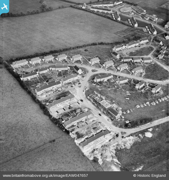
EAW047657 ENGLAND (1952). New housing surrounding Noke Shot and Someries Road, Batford, 1952
© Copyright OpenStreetMap contributors and licensed by the OpenStreetMap Foundation. 2025. Cartography is licensed as CC BY-SA.
Nearby Images (6)
Details
| Title | [EAW047657] New housing surrounding Noke Shot and Someries Road, Batford, 1952 |
| Reference | EAW047657 |
| Date | 27-October-1952 |
| Link | |
| Place name | BATFORD |
| Parish | HARPENDEN |
| District | |
| Country | ENGLAND |
| Easting / Northing | 514391, 215805 |
| Longitude / Latitude | -0.33983517817063, 51.828688892303 |
| National Grid Reference | TL144158 |
Pins
Be the first to add a comment to this image!


![[EAW047657] New housing surrounding Noke Shot and Someries Road, Batford, 1952](http://britainfromabove.org.uk/sites/all/libraries/aerofilms-images/public/100x100/EAW/047/EAW047657.jpg)
![[EAW047655] New housing surrounding Porters Hill and Noke Shot, Batford, 1952](http://britainfromabove.org.uk/sites/all/libraries/aerofilms-images/public/100x100/EAW/047/EAW047655.jpg)
![[EAW047656] New housing surrounding Porters Hill and Noke Shot, Batford, 1952](http://britainfromabove.org.uk/sites/all/libraries/aerofilms-images/public/100x100/EAW/047/EAW047656.jpg)
![[EAW047647] Batford County Primary School (Sauncey Wood Primary School) and new housing surrounding Pickford Hill, Batford, 1952](http://britainfromabove.org.uk/sites/all/libraries/aerofilms-images/public/100x100/EAW/047/EAW047647.jpg)
![[EAW047646] Batford County Primary School (Sauncey Wood Primary School) and new housing surrounding Pickford Hill, Batford, 1952](http://britainfromabove.org.uk/sites/all/libraries/aerofilms-images/public/100x100/EAW/047/EAW047646.jpg)
![[EAW047654] New housing surrounding Pickford Hill, Batford, 1952](http://britainfromabove.org.uk/sites/all/libraries/aerofilms-images/public/100x100/EAW/047/EAW047654.jpg)