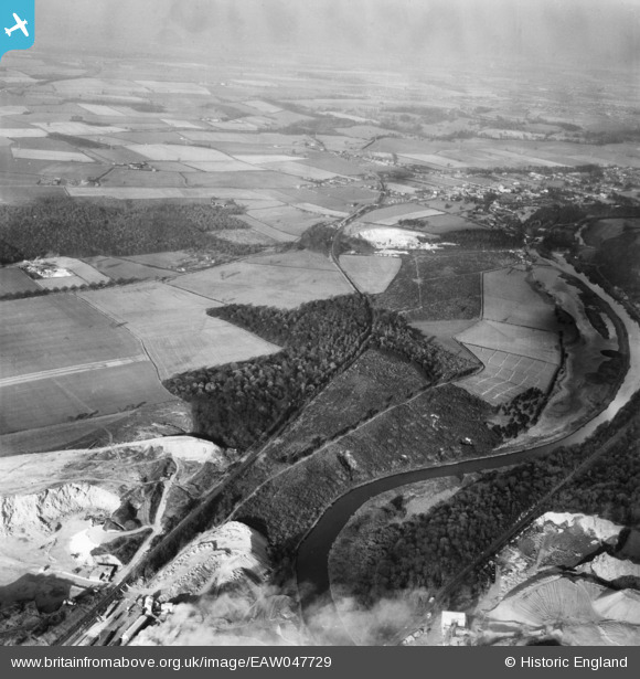
EAW047729 ENGLAND (1952). Pot Ridings Wood with Sprotbrough Quarry in the distance, Cadeby, from the south, 1952
© Copyright OpenStreetMap contributors and licensed by the OpenStreetMap Foundation. 2024. Cartography is licensed as CC BY-SA.
Details
| Title | [EAW047729] Pot Ridings Wood with Sprotbrough Quarry in the distance, Cadeby, from the south, 1952 |
| Reference | EAW047729 |
| Date | 31-October-1952 |
| Link | |
| Place name | CADEBY |
| Parish | CADEBY |
| District | |
| Country | ENGLAND |
| Easting / Northing | 452884, 400323 |
| Longitude / Latitude | -1.2027214851345, 53.496696757974 |
| National Grid Reference | SE529003 |
Pins
 redmist |
Monday 21st of January 2019 08:14:51 PM |


![[EAW047729] Pot Ridings Wood with Sprotbrough Quarry in the distance, Cadeby, from the south, 1952](http://britainfromabove.org.uk/sites/all/libraries/aerofilms-images/public/100x100/EAW/047/EAW047729.jpg)
![[EAW047728] Pot Ridings Wood with Sprotbrough Quarry in the distance, Cadeby, from the south, 1952](http://britainfromabove.org.uk/sites/all/libraries/aerofilms-images/public/100x100/EAW/047/EAW047728.jpg)
![[EAW043501] Pot Ridings Wood, Cadeby, 1952](http://britainfromabove.org.uk/sites/all/libraries/aerofilms-images/public/100x100/EAW/043/EAW043501.jpg)
![[EAW043500] Pot Ridings Wood, Cadeby, 1952](http://britainfromabove.org.uk/sites/all/libraries/aerofilms-images/public/100x100/EAW/043/EAW043500.jpg)