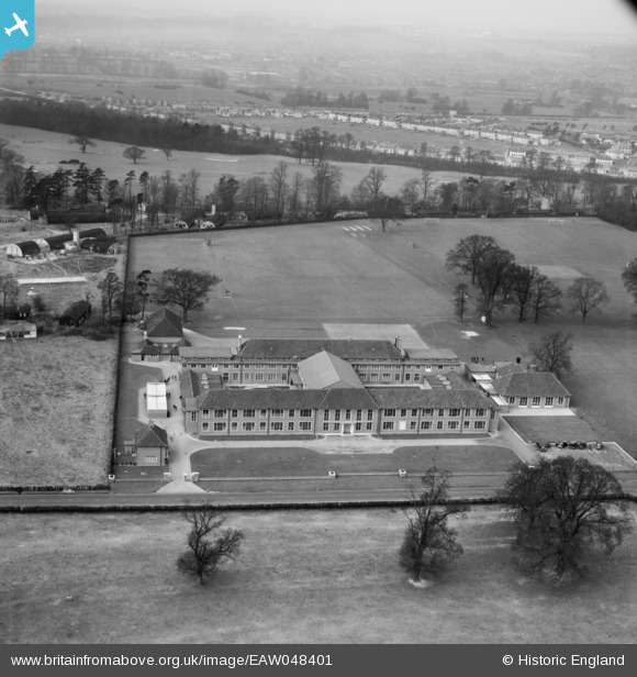
EAW048401 ENGLAND (1953). The Royal Caledonian Schools and environs, Bushey, 1953
© Copyright OpenStreetMap contributors and licensed by the OpenStreetMap Foundation. 2024. Cartography is licensed as CC BY-SA.
Nearby Images (9)
Details
| Title | [EAW048401] The Royal Caledonian Schools and environs, Bushey, 1953 |
| Reference | EAW048401 |
| Date | 5-February-1953 |
| Link | |
| Place name | BUSHEY |
| Parish | |
| District | |
| Country | ENGLAND |
| Easting / Northing | 512987, 197033 |
| Longitude / Latitude | -0.36630150927988, 51.66024331758 |
| National Grid Reference | TQ130970 |
Pins
 Matt Aldred edob.mattaldred.com |
Sunday 8th of November 2020 11:13:16 PM | |
 Matt Aldred edob.mattaldred.com |
Wednesday 19th of August 2020 09:26:59 PM | |
 Matt Aldred edob.mattaldred.com |
Wednesday 19th of August 2020 09:25:38 PM |


![[EAW048401] The Royal Caledonian Schools and environs, Bushey, 1953](http://britainfromabove.org.uk/sites/all/libraries/aerofilms-images/public/100x100/EAW/048/EAW048401.jpg)
![[EAW048399] Bushey Grammar School and the Royal Caledonian Schools on Aldenham Road, Bushey, 1953](http://britainfromabove.org.uk/sites/all/libraries/aerofilms-images/public/100x100/EAW/048/EAW048399.jpg)
![[EPR000488] The Royal Caledonian Schools off Aldenham Road, Bushey, 1935](http://britainfromabove.org.uk/sites/all/libraries/aerofilms-images/public/100x100/EPR/000/EPR000488.jpg)
![[EAW048398] Bushey Grammar School and the Royal Caledonian Schools on Aldenham Road, Bushey, 1953](http://britainfromabove.org.uk/sites/all/libraries/aerofilms-images/public/100x100/EAW/048/EAW048398.jpg)
![[EPR000487] The Royal Caledonian Schools off Aldenham Road, Bushey, 1935. This image was marked by Aero Pictorial Ltd for photo editing.](http://britainfromabove.org.uk/sites/all/libraries/aerofilms-images/public/100x100/EPR/000/EPR000487.jpg)
![[EAW048400] Bushey Grammar School and the Royal Caledonian Schools on Aldenham Road, Bushey, 1953](http://britainfromabove.org.uk/sites/all/libraries/aerofilms-images/public/100x100/EAW/048/EAW048400.jpg)
![[EAW048402] The Royal Caledonian Schools, Bushey Grammar School and Bushey Hall Golf Course, Bushey, from the north-east, 1953](http://britainfromabove.org.uk/sites/all/libraries/aerofilms-images/public/100x100/EAW/048/EAW048402.jpg)
![[EAW048400A] The Royal Caledonian Schools and environs, Bushey, from the south-east, 1953](http://britainfromabove.org.uk/sites/all/libraries/aerofilms-images/public/100x100/EAW/048/EAW048400A.jpg)