
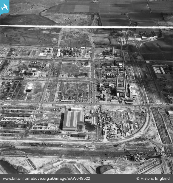
EAW048522 ENGLAND (1953). The Anglo-Iranian Oil Co Ltd Kent Oil Refinery under construction, Isle of Grain, 1953. This image was marked by Aerofilms Ltd for photo editing.
© Copyright OpenStreetMap contributors and licensed by the OpenStreetMap Foundation. 2025. Cartography is licensed as CC BY-SA.
Nearby Images (22)
EAW048522

EAW048516

EAW048561

EAW045768

EAW045764

EAW048562

EAW045767

EAW045753

EAW048525

EAW045780

EAW045772

EAW048566

EAW045752

EAW048518

EAW045766

EAW034855

EAW048563

EAW048528

EAW045771

EAW045778

EAW045777

EAW034851

Details
| Title | [EAW048522] The Anglo-Iranian Oil Co Ltd Kent Oil Refinery under construction, Isle of Grain, 1953. This image was marked by Aerofilms Ltd for photo editing. |
| Reference | EAW048522 |
| Date | 27-March-1953 |
| Link | |
| Place name | ISLE OF GRAIN |
| Parish | ISLE OF GRAIN |
| District | |
| Country | ENGLAND |
| Easting / Northing | 586933, 175304 |
| Longitude / Latitude | 0.69032620629207, 51.445337160279 |
| National Grid Reference | TQ869753 |
Pins
Be the first to add a comment to this image!